Sheidow Park, South Australia
| Sheidow Park Adelaide, South Australia | |||||||||||||||
|---|---|---|---|---|---|---|---|---|---|---|---|---|---|---|---|
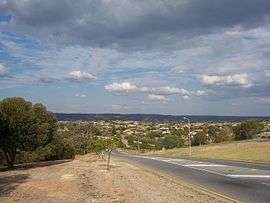 View of Sheidow Park from Adams Road | |||||||||||||||
| Population | 5,667 (2006 census)[1] | ||||||||||||||
| Postcode(s) | 5158 | ||||||||||||||
| Location | 25 km (16 mi) from City-centre | ||||||||||||||
| LGA(s) | City of Marion | ||||||||||||||
| State electorate(s) | Black | ||||||||||||||
| Federal Division(s) | Kingston | ||||||||||||||
| |||||||||||||||
Sheidow Park is a suburb in the south of Adelaide, South Australia. The suburb is approximately 25 kilometres (16 mi) from the city-centre and is situated on coastal hills above the Adelaide Plains.
History
Named after the once prominent Sheidow pastoralist family that previously owned nearly all the land in the area, Sheidow Park is a relatively new suburb; residential development began in earnest in the late 1970s. The Sheidow family, formerly resident at a mansion over-looking Holdfast Bay, now reside on a large estate beside Hallet Cove Beach. Reflecting the suburb's agricultural past is the former railway track that winds through the area - an agricultural route in times gone by. The suburb has been growing progressively larger, absorbing much of Trott Park. The first major residential development in Sheidow Park was West of Trott Park. Nearly two decades later the Higginbotham Woodend Estate commenced on the southern side of Lander Road. The estate, like other planned developments, was released in stages, finishing with the final release in the late 1990s. The estate was essentially square-shaped, bordered by four main boulevards. A curious point is the naming of the streets; it is often a difficult area for visitors to navigate on account of confusing street names, with an unusually high proportion named after either fruits or apparent 'somebodies'. Originally, there was a community centre with shops located centrally on Edward Beck Drive and Lemon Road (now Young Street), opposite the sales centre. However, the centre closed, and two years later the owner planned to convert it to a tavern. The proposal was met with fierce community opposition culminating in the State Government's decision to purchase and use the building as an extension of the current Woodend Primary School. Currently there are local shops within Trott Park, which includes a Pharmacy, supermarket, hairdressers, take away & Indian restaurant. This shopping complex services both Sheidow Park & Trott Park residents.
As of 2007, the suburb is still growing, expanding into the Field River Valley (locally known as 'the Valley') with the Southbank Estate development. The area's semi-rural character is becoming progressively more urban as the process of urbanisation increases.
Schools
There are three schools located within Sheidow Park: all primary schools; two public and one private.
Sheidow Park Primary School[2] is public and caters for students from Reception to Year 7. The school has been serving the community within the suburb since 1980, and is located on Adams Road. It is the only State primary school in the southern area of Adelaide which offers a Steiner Education stream.[3]
Woodend Primary School[4] is the other public school in the suburb and has been teaching students from Reception to Year 7 since 1995. Built in the 1990s, it is the newest school in Sheidow Park and has state-of-the-art amenities. It has the largest student population of all of the local schools. Upon finishing Year 7, students from the two public schools generally attend secondary school at the nearby Hallett Cove R-12 High School or at Seaview High.
The only private school in Sheidow Park is St Martin de Porres, a Catholic school that teaches Reception to Year 5. Students from St. Martin's are generally channelled to other south-west Adelaide Catholic schools, including Sacred Heart College Middle School, Marymount College and Cabra Dominican College.
Transport
Sheidow Park is located close to the major north-south thoroughfares of South Road and Londsdale Highway. Additionally, the area is serviced by Adelaide Metro bus routes. It is also close to a major entrance to the Southern Expressway.
See also
References
- ↑ Australian Bureau of Statistics (25 October 2007). "Sheidow Park (State Suburb)". 2006 Census QuickStats. Retrieved 2 July 2008.
- ↑ Sheidow Park Primary School, www.sheidowps.sa.edu.au
- ↑ Our Curriculum, www.sheidowps.sa.edu.au
- ↑ Woodend Primary School, www.woodendps.sa.edu.au