Sharon, Pennsylvania
| Sharon, Pennsylvania | |
|---|---|
| City | |
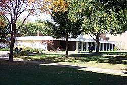 Science Building and Forker Laboratory on the Penn State Shenango Campus in Sharon | |
| Nickname(s): The Friendly City | |
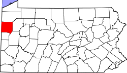
 Location of Sharon in Mercer County, Pennsylvania. | |
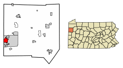
 Sharon, Pennsylvania Location of Sharon within Pennsylvania | |
| Coordinates: 41°13′48″N 80°29′56″W / 41.23000°N 80.49889°WCoordinates: 41°13′48″N 80°29′56″W / 41.23000°N 80.49889°W | |
| Country | United States |
| State | Pennsylvania |
| County | Mercer |
| Established | 1795 |
| Incorporated (borough) | 6 October 1841 |
| Incorporated (city) | 17 December 1917 |
| Government | |
| • Type | Home Rule |
| Area[1] | |
| • Total | 3.77 sq mi (9.76 km2) |
| • Land | 3.77 sq mi (9.76 km2) |
| • Water | 0.00 sq mi (0.00 km2) 0% |
| Elevation | 1,000 ft (300 m) |
| Population (2010) | |
| • Total | 14,038 |
| • Estimate (2016)[2] | 13,405 |
| • Density | 3,555.70/sq mi (1,373.02/km2) |
| Time zone | UTC-4 (EST) |
| • Summer (DST) | UTC-5 (EDT) |
| Zip code | 16146 |
| Area code(s) | 724 |
| FIPS code | 42-69720 |
| Website | www.cityofsharon.net |
Sharon is a city in Mercer County, Pennsylvania, in the United States, 75 miles (121 km) northwest of Pittsburgh. It is part of the Youngstown-Warren-Boardman, OH-PA Metropolitan Statistical Area.
It is the home of the Vocal Group Hall of Fame.
History
The Sharon area was first settled in 1795. It was incorporated as a borough on 6 October 1841, and incorporated as a city on December 17, 1918. The city operated under the Pennsylvania third-class city code until 2008, at which point it adopted a home rule charter under which the elected position of mayor was replaced with a hired city manager and financial officer.
The founding families of Sharon first settled on a flat plain bordering the Shenango River, between two hills on the southwestern edge of what is today Sharon's downtown business district. According to local legend, the community received its name from a Bible-reading settler who likened the location to the Plain of Sharon in Israel.
Initially a center of coal mining, Sharon's economy transitioned to iron and steelmaking and other heavy industry after the arrival of the Erie Extension Canal in the 1840s. Following the extensive national deindustrialization of the 1970s and '80s, the city's economy diversified and is now based primarily on light industry, education, health care, and social services.
The Frank H. Buhl Mansion was added to the National Register of Historic Places in 1977.[3]
Sharon is the home of Quaker Steak & Lube and The Vocal Group Hall of Fame. Other local attractions are The Winner off-price fashion store, Reyer's shoes, and Daffin's Candy.
Geography
Sharon is located at 41°13′48″N 80°29′56″W / 41.23000°N 80.49889°W[4] in southwest Mercer County. The city borders the city of Hermitage to the north and east, the city of Farrell to the south, and on the west the census-designated places of Masury and West Hill, Ohio.
According to the United States Census Bureau, the city has a total area of 3.8 square miles (9.8 km2), all land. However, the Shenango River runs through the city and provides drinking water to Sharon and several surrounding communities.
Demography
| Historical population | |||
|---|---|---|---|
| Census | Pop. | %± | |
| 1850 | 541 | — | |
| 1860 | 900 | 66.4% | |
| 1870 | 4,221 | 369.0% | |
| 1880 | 5,684 | 34.7% | |
| 1890 | 7,459 | 31.2% | |
| 1900 | 8,916 | 19.5% | |
| 1910 | 15,270 | 71.3% | |
| 1920 | 21,747 | 42.4% | |
| 1930 | 25,908 | 19.1% | |
| 1940 | 25,622 | −1.1% | |
| 1950 | 26,454 | 3.2% | |
| 1960 | 25,267 | −4.5% | |
| 1970 | 22,653 | −10.3% | |
| 1980 | 19,057 | −15.9% | |
| 1990 | 17,493 | −8.2% | |
| 2000 | 16,328 | −6.7% | |
| 2010 | 14,038 | −14.0% | |
| Est. 2016 | 13,405 | [2] | −4.5% |
| Sources:[5][6][7][8] | |||
As of the census[7] of 2000, there were 16,328 people, 6,791 households, and 4,189 families residing in the city. The population density was 4,342.6 people per square mile (1,676.7/km²). There were 7,388 housing units at an average density of 1,964.9 per square mile (758.6/km²). The racial makeup of the city was 86.44% White, 10.85% African American, 0.18% Native American, 0.21% Asian, 0.02% Pacific Islander, 0.23% from other races, and 2.08% from two or more races. Hispanic or Latino of any race were 0.88% of the population.
From the Census Ancestry Question, Sharon has the following ethnic make-up: German 21%, Irish 14%, Italian 11%, Black or African American 11%, English 8%, Polish 5%, Slovak 5%, Welsh 3%, Scots-Irish 2%, Hungarian 2%, Dutch 2%, French (except Basque) 2%, Croatian 1%, Scottish 1%, Russian 1%, Swedish 1%, Arab 1%, Slavic 1%, American Indian tribes, specified 1%. Sharon's Jewish community is served by the Reform Jewish Temple Beth Israel.
There were 6,791 households, out of which 28.1% had children under the age of 18 living with them, 40.7% were married couples living together, 16.6% had a female householder with no husband present, and 38.3% were non-families. 33.7% of all households were made up of individuals, and 15.5% had someone living alone who was 65 years of age or older. The average household size was 2.33 and the average family size was 2.97.
In the city, the population was distributed with 24.4% under the age of 18, 8.0% from 18 to 24, 27.2% from 25 to 44, 22.0% from 45 to 64, and 18.5% who were 65 years of age or older. The median age was 38 years. For every 100 females, there were 88.3 males. For every 100 females age 18 and over, there were 83.7 males.
The median income for a household in the city was $26,945, and the median income for a family was $34,581. Males had a median income of $30,072 versus $20,988 for females. The per capita income for the city was $15,913. About 14.0% of families and 17.6% of the population were below the poverty line, including 25.8% of those under age 18 and 8.8% of those age 65 or over.
Education
The Sharon City School District maintains three K-6 elementary schools: Case Avenue, C.M. Musser, and West Hill. It has one combined middle/high school, the 7-12 Sharon Middle/High School.
Sharon is home to the Shenango campus of Pennsylvania State University, which offers several two-year and four-year degrees. It also hosts Laurel Technical Institute, a for-profit trade school, and the Sharon Regional Health System School of Nursing.
Notable people
- Mike Archie - former National Football League running back
- Carmen Argenziano - actor Stargate SG-1
- Teryl Austin - National Football League coach, Cincinnati Bengals, Defensive Coordinator
- Jane J. Boyle - judge
- Tony Butala - founder, lead vocalist, The Lettermen, president Vocal Group Hall of Fame
- Mike Connell - former National Football League punter
- John Daverio - professor of music
- Nate Dunn - artist, Pennsylvania Impressionism School
- John H. Garvey - President, The Catholic University of America (2010–present)
- Charlie Gibson - catcher for the Philadelphia Athletics (1905)
- Bob Golub - stand-up comedian, actor, writer, filmmaker
- Mick Goodrick - jazz guitarist
- Erwin Hahn - physicist
- Randy Holloway - former National Football League defensive end
- Marc Howard - former Philadelphia news anchor
- Marlin Jackson - National Football League cornerback
- Benjamin Jarrett - Republican member of the U.S. House of Representatives
- Jane Katz (born 1943), Olympic swimmer
- John Kiriakou - former CIA officer convicted of violating the Intelligence Identities Protection Act; notable in waterboarding debate
- Britteny Lee - visual development artist, Oscar winner for work on "Frozen" (animated film)
- Ty Longley - guitarist, Great White
- John D. MacDonald - best-selling crime novelist
- Jack Marin - former National Basketball Association player
- Paul McKee - professor and author of children's reading primers
- Hugh McKinnis - former Canadian Football League and National Football League running back
- Bill Murray - nationally syndicated cartoonist and children book illustrator
- Grover Norquist - founder and president, Americans for Tax Reform
- Lester Rawlins - actor
- Mike Sebastian - former halfback in the National Football League and second American Football League
- Frank Secich - author, rock musician and member of the group Blue Ash
- Hershel Shanks - founder, Biblical Archaeology Society, editor, Biblical Archaeology Review
- Willie Somerset, ABA All-Star professional basketball player
- Lorenzo Styles - former linebacker for Atlanta Falcons and St. Louis Rams; head coach for the Marion Blue Racers
- James Henry Taylor - professor of mathematics
- Leo Yankevich - poet, translator, editor of The New Formalist
Broadcast media
Television
Because of Sharon's location on the Pennsylvania/Ohio border, it is served by WKBN-TV (CBS), WFMJ-TV (NBC), WYTV (ABC), WYFX-LD (Fox) and WBCB (CW), all broadcast from nearby Youngstown, OH.
Radio
Sharon is served by AM radio stations such as WLOA (1470 AM) (Farrell, PA), WPIC (790 AM), WKBN (570 AM) (Youngstown, OH), and by FM radio stations such as WYFM/"Y-103" (102.9 FM), WLLF/"The River" (96.7 FM) (Mercer, PA), WYLE/"Willie 95.1" (95.1 FM) (Grove City, PA), WMXY/"Mix 98.9" (98.9 FM) (Youngstown, OH) and WWIZ/"Z-104" (West Middlesex, PA).
See also
References
- ↑ "2016 U.S. Gazetteer Files". United States Census Bureau. Retrieved Aug 14, 2017.
- 1 2 "Population and Housing Unit Estimates". Retrieved June 9, 2017.
- ↑ National Park Service (2010-07-09). "National Register Information System". National Register of Historic Places. National Park Service.
- ↑ "US Gazetteer files: 2010, 2000, and 1990". United States Census Bureau. 12 February 2011. Retrieved 23 April 2011.
- ↑ "Number of Inhabitants: Pennsylvania" (PDF). 18th Census of the United States. U.S. Census Bureau. Retrieved 22 November 2013.
- ↑ "Pennsylvania: Population and Housing Unit Counts" (PDF). U.S. Census Bureau. Retrieved 22 November 2013.
- 1 2 "American FactFinder". United States Census Bureau. Retrieved 2008-01-31.
- ↑ "Incorporated Places and Minor Civil Divisions Datasets: Subcounty Population Estimates: April 1, 2010 to July 1, 2012". U.S. Census Bureau. Archived from the original on 17 June 2013. Retrieved 25 November 2013.
External links
- City website
- Sharon, PA/city-data