Sandy Lake, Pennsylvania
| Sandy Lake, Pennsylvania | |
|---|---|
| Borough | |
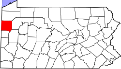
 Location of Sandy Lake in Mercer County, Pennsylvania. | |
 Sandy Lake, Pennsylvania Location of Sandy Lake within Pennsylvania | |
| Coordinates: 41°21′04″N 80°05′00″W / 41.35111°N 80.08333°WCoordinates: 41°21′04″N 80°05′00″W / 41.35111°N 80.08333°W | |
| Country | United States |
| State | Pennsylvania |
| County | Mercer |
| Established | 1849 |
| Government | |
| • Mayor | Dan Hemminger |
| Area[1] | |
| • Total | 0.83 sq mi (2.16 km2) |
| • Land | 0.83 sq mi (2.16 km2) |
| • Water | 0.00 sq mi (0.00 km2) |
| Population (2010) | |
| • Total | 659 |
| • Estimate (2016)[2] | 644 |
| • Density | 774.04/sq mi (298.80/km2) |
| Time zone | UTC-4 (EST) |
| • Summer (DST) | UTC-5 (EDT) |
| Zip code | 16145 |
| Area code(s) | 724 |
| Website | http://sandylakeborough.com |
Sandy Lake is a borough in Mercer County, Pennsylvania, United States. It established in 1849. The population was 743 at the 2000 census. It is part of the Youngstown-Warren-Boardman, OH-PA Metropolitan Statistical Area.
Geography
Sandy Lake is located at 41°21′04″N 80°05′00″W / 41.351165°N 80.083220°W (41.351165, -80.083220).[3]
According to the United States Census Bureau, the borough has a total area of 0.8 square miles (2.1 km2), all of it land.
Demographics
| Historical population | |||
|---|---|---|---|
| Census | Pop. | %± | |
| 1870 | 428 | — | |
| 1880 | 730 | 70.6% | |
| 1890 | 721 | −1.2% | |
| 1900 | 632 | −12.3% | |
| 1910 | 639 | 1.1% | |
| 1920 | 645 | 0.9% | |
| 1930 | 679 | 5.3% | |
| 1940 | 718 | 5.7% | |
| 1950 | 767 | 6.8% | |
| 1960 | 838 | 9.3% | |
| 1970 | 772 | −7.9% | |
| 1980 | 779 | 0.9% | |
| 1990 | 722 | −7.3% | |
| 2000 | 743 | 2.9% | |
| 2010 | 659 | −11.3% | |
| Est. 2016 | 644 | [2] | −2.3% |
| Sources:[4][5][6] | |||
As of the census[5] of 2000, there were 743 people, 298 households, and 211 families residing in the borough. The population density was 896.4 people per square mile (345.6/km2). There were 330 housing units at an average density of 398.1 per square mile (153.5/km2). The racial makeup of the borough was 99.33% White, 0.13% African American, 0.40% Asian, and 0.13% from two or more races. Hispanic or Latino of any race were 0.13% of the population.
There were 298 households, out of which 36.2% had children under the age of 18 living with them, 55.0% were married couples living together, 14.4% had a female householder with no husband present, and 28.9% were non-families. 24.5% of all households were made up of individuals, and 10.7% had someone living alone who was 65 years of age or older. The average household size was 2.49 and the average family size was 2.94.
In the borough the population was spread out, with 26.6% under the age of 18, 7.8% from 18 to 24, 27.3% from 25 to 44, 21.0% from 45 to 64, and 17.2% who were 65 years of age or older. The median age was 37 years. For every 100 females there were 85.8 males. For every 100 females age 18 and over, there were 87.9 males.
The median income for a household in the borough was $34,231, and the median income for a family was $38,958. Males had a median income of $32,159 versus $19,712 for females. The per capita income for the borough was $15,460. About 12.7% of families and 16.6% of the population were below the poverty line, including 30.0% of those under age 18 and 11.6% of those age 65 or over.
Notable people
- Terry Turner, professional baseball player
References
- ↑ "2016 U.S. Gazetteer Files". United States Census Bureau. Retrieved Aug 14, 2017.
- 1 2 "Population and Housing Unit Estimates". Retrieved June 9, 2017.
- ↑ "US Gazetteer files: 2010, 2000, and 1990". United States Census Bureau. 2011-02-12. Retrieved 2011-04-23.
- ↑ "Census of Population and Housing". U.S. Census Bureau. Retrieved 11 December 2013.
- 1 2 "American FactFinder". United States Census Bureau. Retrieved 2008-01-31.
- ↑ "Incorporated Places and Minor Civil Divisions Datasets: Subcounty Resident Population Estimates: April 1, 2010 to July 1, 2012". Population Estimates. U.S. Census Bureau. Archived from the original on 17 June 2013. Retrieved 11 December 2013.