Shady Grove, Houston County, Texas
Shady Grove is an unincorporated community in Houston County, Texas. It is located at the intersection of Farm to Market Road 232, US Highway 287, and County Road 4150, about 10 miles from Crockett.[1][2]
History
Shady Grove was settled around the 1850s. It soon got a post office, but closed in 1866. Two Baptist churches were built in the 1860s and the 1890s where they still stand today.[3][4] In the 1930s the churches, a cemetery, and a few houses were in the area. World War II caused most of the residents to move away but a few residents still remained. However, by the 1990s it was all but abandoned.[5]
Education
Most students in Shady Grove attend the Crockett Independent School District. The west side of County Road 4150 is in the Lovelady Independent School District.[6][7]
Cemetery
As of 2013, there was an effort to preserve the cemetery in the area. It started in 2012 when families in the area and students from nearby Stephen F. Austin State University helped cleaned up and discovered unknown gravesites. It was later deemed a Historical Texas Cemetery by the Texas Historical Commission.[8]
References
- ↑ "Shady Grove". Geographic Names Information System. United States Geological Survey.
- ↑ "Google Maps". Google Maps. Retrieved 2018-04-21.
- ↑ "Google Maps". Google Maps. Retrieved 2018-04-21.
- ↑ "Google Maps". Google Maps. Retrieved 2018-04-21.
- ↑ H., BISHOP, ELIZA (2010-06-15). "SHADY GROVE, TX [HOUSTON COUNTY]". tshaonline.org. Retrieved 2018-04-21.
- ↑ "Crockett ISD :: School District Map of the Crockett ISD :: MapTechnica". www.maptechnica.com. Retrieved 2018-04-21.
- ↑ "Lovelady ISD :: School District Map of the Lovelady ISD :: MapTechnica". www.maptechnica.com. Retrieved 2018-04-21.
- ↑ "Old Shady Grove Cemetery and the Texas Historical Commission (January 2013) | Archive - 2013 | Lynda Jones | Local Writers' Columns | Center for Regional Heritage Research | SFASU". www.sfasu.edu. Retrieved 2018-04-21.
Municipalities and communities of Houston County, Texas, United States | ||
|---|---|---|
| Cities | 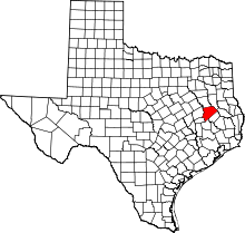 | |
| Unincorporated communities | ||
| Ghost towns | ||
| Footnotes | ‡This populated place also has portions in an adjacent county or counties | |
Coordinates: 31°14′03″N 95°19′26″W / 31.23417°N 95.32389°W