Sextonville, Wisconsin
| Sextonville, Wisconsin | |
|---|---|
| Census-designated place | |
 Sextonville, Wisconsin | |
| Coordinates: 43°16′42″N 90°17′27″W / 43.27833°N 90.29083°WCoordinates: 43°16′42″N 90°17′27″W / 43.27833°N 90.29083°W | |
| Country | United States |
| State | Wisconsin |
| County | Richland |
| Area | |
| • Total | 0.876 sq mi (2.27 km2) |
| • Land | 0.876 sq mi (2.27 km2) |
| • Water | 0 sq mi (0 km2) |
| Elevation | 728 ft (222 m) |
| Population (2010) | |
| • Total | 551 |
| • Density | 630/sq mi (240/km2) |
| Time zone | UTC-6 (Central (CST)) |
| • Summer (DST) | UTC-5 (CDT) |
| ZIP code | 53584 |
| Area code(s) | 608 |
| GNIS feature ID | 1578620[1] |
Sextonville is an unincorporated census-designated place located in the town of Buena Vista in Richland County, Wisconsin, United States. Sextonville is located on U.S. Route 14 southeast of Richland Center. Sextonville has a post office with ZIP code 53584.[2] As of the 2010 census, its population is 551.[3]
References
Municipalities and communities of Richland County, Wisconsin, United States | ||
|---|---|---|
| City | 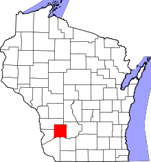 | |
| Villages | ||
| Towns | ||
| CDPs | ||
| Unincorporated communities |
| |
| Former communities | ||
| Footnotes | ‡This populated place also has portions in an adjacent county or counties | |
This article is issued from
Wikipedia.
The text is licensed under Creative Commons - Attribution - Sharealike.
Additional terms may apply for the media files.