Sestola
| Sestola | |
|---|---|
| Comune | |
| Comune di Sestola | |
 | |
 Sestola Location of Sestola in Italy | |
| Coordinates: 44°14′N 10°46′E / 44.233°N 10.767°ECoordinates: 44°14′N 10°46′E / 44.233°N 10.767°E | |
| Country | Italy |
| Region | Emilia-Romagna |
| Province | Modena (MO) |
| Frazioni | Casine, Castellaro, Rocchetta Sandri, Roncoscaglia, Vesale |
| Government | |
| • Mayor | Marco Bonucchi |
| Area | |
| • Total | 52.47 km2 (20.26 sq mi) |
| Elevation | 1,020 m (3,350 ft) |
| Population (31 December 2014)[1] | |
| • Total | 2,500 |
| • Density | 48/km2 (120/sq mi) |
| Demonym(s) | Sestolesi |
| Time zone | UTC+1 (CET) |
| • Summer (DST) | UTC+2 (CEST) |
| Postal code | 41029 |
| Dialing code | 0536 |
| Website | Official website |
Sestola (Sestolese: Sèstula; Frignanese: Sèstla) is a comune (municipality) in the Province of Modena in the Italian region Emilia-Romagna, located about 60 kilometres (37 mi) southwest of Bologna and about 50 kilometres (31 mi) southwest of Modena. It is located near the Monte Cimone and other mountains of the northern Apennines separating Emilia and Tuscany.
Sestola borders the following municipalities: Fanano, Fiumalbo, Lizzano in Belvedere, Montecreto, Montese, Pavullo nel Frignano, Riolunato.
Main sights
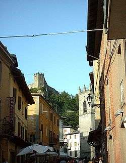
- Fortress, rebuilt in the 16th century but dating to several centuries before.
- Giardino Botanico Alpino "Esperia"
- San Nicola di Bari church
References
External links

| Authority control |
|---|
This article is issued from
Wikipedia.
The text is licensed under Creative Commons - Attribution - Sharealike.
Additional terms may apply for the media files.