Sesekinika, Ontario
| Sesekinika | |
|---|---|
| Unincorporated community | |
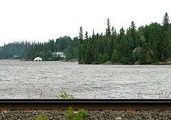 Sesekinika Lake | |
 Sesekinika Location in Ontario | |
| Coordinates: 48°11′01″N 80°14′08″W / 48.18361°N 80.23556°WCoordinates: 48°11′01″N 80°14′08″W / 48.18361°N 80.23556°W[1] | |
| Country | Canada |
| Province | Ontario |
| District | Timiskaming |
| Geographic township | Maisonville |
| Elevation[2] | 306 m (1,004 ft) |
| Time zone | UTC-5 (Eastern Time Zone) |
| • Summer (DST) | UTC-4 (Eastern Time Zone) |
| Postal Code | P0K 1T0 |
| Area code(s) | 705, 249 |
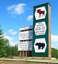
Highway 11 crosses the geographic division between the Atlantic and Arctic Watersheds at Sesekinika
Sesekinika is an unincorporated community in geographic Maisonville Township,[3] in the Unorganized West Part of Timiskaming District in northeastern Ontario, Canada.[1]
The community is located along the Ontario Northland Railway at the eastern terminus of Ontario Highway 570.
References
- 1 2 "Sesekinika". Geographical Names Data Base. Natural Resources Canada. Retrieved 2016-12-22.
- ↑ Elevation taken at geographic coordinates from Google Maps. Accessed 2016-12-22.
- ↑ "Maisonville" (PDF). Geology Ontario - Historic Claim Maps. Ontario Ministry of Northern Development, Mines and Forestry. Retrieved 2016-12-22.
Other map sources:
- Map 12 (PDF) (Map). 1 : 1,600,000. Official road map of Ontario. Ministry of Transportation of Ontario. 2015-01-01. Retrieved 2016-12-22.
- Restructured municipalities - Ontario map #3 (Map). Restructuring Maps of Ontario. Ontario Ministry of Municipal Affairs and Housing. 2006. Retrieved 2016-12-22.
This article is issued from
Wikipedia.
The text is licensed under Creative Commons - Attribution - Sharealike.
Additional terms may apply for the media files.