Servia-Velventos
| Servia–Velventos Σέρβια-Βελβεντός | |
|---|---|
 | |
 Servia–Velventos Location within the region 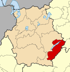 | |
| Coordinates: 40°11′N 22°0′E / 40.183°N 22.000°ECoordinates: 40°11′N 22°0′E / 40.183°N 22.000°E | |
| Country | Greece |
| Administrative region | West Macedonia |
| Regional unit | Kozani |
| Government | |
| • Mayor | Vasilios Konstantopoulos |
| Area | |
| • Municipality | 728.17 km2 (281.15 sq mi) |
| Population (2011)[1] | |
| • Municipality | 14,830 |
| • Municipality density | 20/km2 (53/sq mi) |
| Time zone | UTC+2 (EET) |
| • Summer (DST) | UTC+3 (EEST) |
| Postal code | 50500 |
| Area code(s) | 24640 |
| Vehicle registration | KZ |
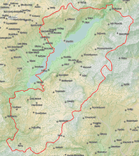
Servia–Velventos (Greek: Σέρβια-Βελβεντός, Sérvia-Velventós) is a municipality in the Kozani regional unit, Greece. The seat of the municipality is the town Servia.[2] The municipality has an area of 728.166 km2.[3]
Municipality
The municipality Servia–Velventos was formed at the 2011 local government reform by the merger of the following 4 former municipalities, that became municipal units:[2]
References
- ↑ "Απογραφή Πληθυσμού - Κατοικιών 2011. ΜΟΝΙΜΟΣ Πληθυσμός" (in Greek). Hellenic Statistical Authority.
- 1 2 Kallikratis law Greece Ministry of Interior (in Greek)
- ↑ "Population & housing census 2001 (incl. area and average elevation)" (PDF) (in Greek). National Statistical Service of Greece.
Administrative division of the Western Macedonia Region | ||
|---|---|---|
| Regional unit of Florina | 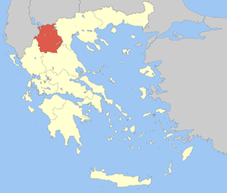 | |
| Regional unit of Grevena | ||
| Regional unit of Kastoria | ||
| Regional unit of Kozani | ||
| ||
This article is issued from
Wikipedia.
The text is licensed under Creative Commons - Attribution - Sharealike.
Additional terms may apply for the media files.