Senice na Hané
| Senice na Hané | |||
|---|---|---|---|
| Municipality | |||
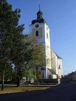 Saint Mary Magdalene Church | |||
| |||
 Senice na Hané | |||
| Coordinates: 49°37′21″N 17°5′18″E / 49.62250°N 17.08833°ECoordinates: 49°37′21″N 17°5′18″E / 49.62250°N 17.08833°E | |||
| Country |
| ||
| Region | Olomouc | ||
| District | Olomouc | ||
| Area | |||
| • Total | 19.24 km2 (7.43 sq mi) | ||
| Elevation | 238 m (781 ft) | ||
| Population (2012) | |||
| • Total | 1,816 | ||
| • Density | 94/km2 (240/sq mi) | ||
| Postal code | 783 22 až 783 45 | ||
| Website | http://www.senicenahane.cz | ||


Senice na Hané (German: Groß Senitz) is a village and municipality (obec) in Olomouc District in the Olomouc Region of the Czech Republic.
The municipality covers an area of 19.24 square kilometres (7.43 sq mi), and has a population of 1,578 (as at 1 January 2009).
Senice na Hané lies approximately 13 kilometres (8 mi) west of Olomouc and 199 km (124 mi) east of Prague.
References
| Wikimedia Commons has media related to Senice na Hané. |
This article is issued from
Wikipedia.
The text is licensed under Creative Commons - Attribution - Sharealike.
Additional terms may apply for the media files.