Hněvotín
| Hněvotín | |||
|---|---|---|---|
| Municipality | |||
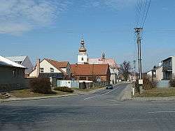 Church of Saint Leonard | |||
| |||
 Hněvotín | |||
| Coordinates: 49°34′21″N 17°10′52″E / 49.57250°N 17.18111°ECoordinates: 49°34′21″N 17°10′52″E / 49.57250°N 17.18111°E | |||
| Country |
| ||
| Region | Olomouc | ||
| District | Olomouc | ||
| Area | |||
| • Total | 11.72 km2 (4.53 sq mi) | ||
| Elevation | 244 m (801 ft) | ||
| Population (2006) | |||
| • Total | 1,321 | ||
| • Density | 110/km2 (290/sq mi) | ||
| Postal code | 783 47 | ||
| Website | http://www.hnevotin.cz | ||


Hněvotín (German: Nebotein) is a village and municipality (obec) in Olomouc District in the Olomouc Region of the Czech Republic.
The municipality covers an area of 11.72 square kilometres (4.53 sq mi), and has a population of 1,321 (as at 3 July 2006).
Hněvotín lies approximately 6 kilometres (4 mi) south-west of Olomouc and 207 km (129 mi) east of Prague.
References
| Wikimedia Commons has media related to Hněvotín. |
This article is issued from
Wikipedia.
The text is licensed under Creative Commons - Attribution - Sharealike.
Additional terms may apply for the media files.