Seiser Alm
Coordinates: 46°32′28″N 11°38′41″E / 46.54111°N 11.64472°E
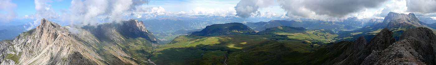
Seiser Alm (Italian: Alpe di Siusi, Ladin: Mont Sëuc) is a Dolomite plateau and the largest high-altitude Alpine meadow (German: Alm) in Europe. Located in Italy's South Tyrol province in the Dolomites mountain range, it is a major tourist attraction, notably for skiing and hiking.
Geography
It is located in the western part of the Dolomites and has an altitude between 1680 m s.l.m. and the 2350 m s.l.m. and extends for 52 km² between Val Gardena to the north, the Sassolungo Group to the north-east and the Sciliar massif to the south-east, which with its unmistakable profile is one of the most famous symbols of all the Dolomites. Given the vastness of the area, from here it is possible to admire a large number of mountain groups: among others, the Sella Group, the Rosengarten group and the Marmolada.
It is an alp, it is an area where pasture is practiced, the largest in Europe, divided into numerous plots reserved to grazing or from which the farmers get hay for their farms located downstream.
The eastern part has been included since 1975 in the Sciliar natural park.
Further reading
- Alberti, Alberto (1975). "Sodium-rich dachiardite from Alpe di Siusi, Italy". Contributions to Mineralogy and Petrology. 49 (1): 63–6. Bibcode:1975CoMP...49...63A. doi:10.1007/BF00371079.
- Keim, Lorenz (2008). "Geologie im Gebiet Schlern-Seiser Alm: vom Tethysmeer zum Gebirge" [Geology in the Schleern-Seiser Alm area: from the Tethyan Sea to mountain building]. Gredleriana (in German). 8: 25–46.
| Wikimedia Commons has media related to Seiser Alm. |