Seabrook, Victoria
| Seabrook Melbourne, Victoria | |||||||||||||||
|---|---|---|---|---|---|---|---|---|---|---|---|---|---|---|---|
 Homestead Run | |||||||||||||||
 Seabrook | |||||||||||||||
| Coordinates | 37°52′34″S 144°45′29″E / 37.876°S 144.758°ECoordinates: 37°52′34″S 144°45′29″E / 37.876°S 144.758°E | ||||||||||||||
| Population | 5,124 (2016)[1] | ||||||||||||||
| • Density | 3,200/km2 (8,290/sq mi) | ||||||||||||||
| Postcode(s) | 3028 | ||||||||||||||
| Area | 1.6 km2 (0.6 sq mi) | ||||||||||||||
| Location | 19.5 km (12 mi) from Melbourne | ||||||||||||||
| LGA(s) | City of Hobsons Bay | ||||||||||||||
| State electorate(s) | Altona | ||||||||||||||
| Federal Division(s) | Lalor | ||||||||||||||
| |||||||||||||||
Seabrook is a suburb of Melbourne, Victoria, Australia, 19 km south-west of Melbourne's Central Business District, located within the City of Hobsons Bay local government area. Seabrook recorded a population of 5,124 at the 2016 Census.
Facilities
The suburb has a small shopping area with some take-away food stores and a service station located on Point Cook Road. Seabrook Primary School also serves the area for education. Although a public school, Seabrook Primary School ranks amongst the top schools in the state of Victoria. Seabrook Primary School has been an International Baccalaureate (IB) World School since September 2011 and it is authorised to offer the IB Primary Years Programme.
Notable people
- Cecil Exum
- Dante Exum
- Connor Menadue
- Megan Wyndo
Gallery
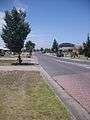 Seabrook Boulevard
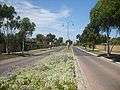 Homestead Run
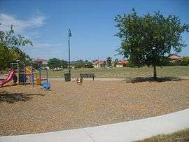
- Homestead Run Reserve
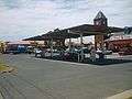 "Hand-e-Food" convenience store and petrol station
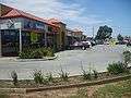 Seabrook Shopping Centre
References
| Wikimedia Commons has media related to Seabrook, Victoria. |
- ↑ Australian Bureau of Statistics (27 June 2017). "Seabrook (State Suburb)". 2016 Census QuickStats. Retrieved 21 July 2017.

External links
This article is issued from
Wikipedia.
The text is licensed under Creative Commons - Attribution - Sharealike.
Additional terms may apply for the media files.