Saskatchewan Highway 60
| ||||
|---|---|---|---|---|
| Route information | ||||
| Length | 23.2 km[1] (14.4 mi) | |||
| Major junctions | ||||
| North end |
| |||
| South end | Pike Lake Provincial Park | |||
| Location | ||||
| Rural municipalities | Corman Park, Vanscoy | |||
| Highway system | ||||
|
Provincial highways in Saskatchewan
| ||||
.svg.png)
Highway 60 is a provincial highway in the Canadian province of Saskatchewan. It runs from Highway 7 near Saskatoon to Pike Lake Provincial Park. The highway is approximately 23 km (14 mi) long.[1] This route primarily serves as a link connecting Saskatonians to Pike Lake and its campground, though it is also an important local road for acreages and businesses in the area. The speed limit is 90 km/h (55 mph). The Saskatchewan Railway Museum is located at the Hawker Siding about 3 km from Highway 7. Hawker Siding was previously known as Eaton Siding. A Ukrainian church is farther south on the highway.
Photo gallery
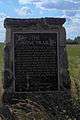 Bone Trail marker along Hwy 60
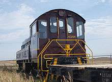
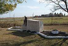 Eaton Internment Camp of World War I
Major intersections
From north to south:[2]
| Location | km[1] | mi | Destinations | Notes | |
|---|---|---|---|---|---|
| Corman Park No. 344 | 0.0 | 0.0 | Northern terminus | ||
| 11.0 | 6.8 | ||||
| Vanscoy No. 345 | 21.0 | 13.0 | |||
| 23.2 | 14.4 | Pike Lake Provincial Park | |||
| 1.000 mi = 1.609 km; 1.000 km = 0.621 mi | |||||
References
- 1 2 3 Google (February 12, 2018). "Highway 60 in Saskatchewan" (Map). Google Maps. Google. Retrieved February 12, 2018.
- ↑ MapArt Publishing Corp. Saskatchewan Road Atlas (2007 ed.). Oshawa, ON: Peter Heiler Ltd. p. 32. ISBN 1-55368-020-0.
This article is issued from
Wikipedia.
The text is licensed under Creative Commons - Attribution - Sharealike.
Additional terms may apply for the media files.