Saratoga, Arkansas
| Saratoga, Arkansas | |
|---|---|
| Unincorporated community | |
 Saratoga  Saratoga | |
| Coordinates: 33°45′06″N 93°54′10″W / 33.75167°N 93.90278°WCoordinates: 33°45′06″N 93°54′10″W / 33.75167°N 93.90278°W | |
| Country | United States |
| State | Arkansas |
| County | Hempstead, Howard |
| Elevation | 459 ft (140 m) |
| Time zone | UTC-6 (Central (CST)) |
| • Summer (DST) | UTC-5 (CDT) |
| ZIP code | 71859 |
| Area code(s) | 870 |
| GNIS feature ID | 58589[1] |
Saratoga is an unincorporated community in Hempstead[2] and Howard counties, Arkansas, United States. Saratoga is located at the junction of Arkansas highways 32, 73 and 355, 5 miles (8.0 km) south of Tollette. Saratoga has a post office with ZIP code 71859.[3]
Residents are served by the Mineral Springs Saratoga School District. On July 1, 2004, the Saratoga School District consolidated into the Mineral Springs School District.[4] The local high school is currently Mineral Springs High School; the district previously operated Saratoga High School until its 2012 closure.[5]
References
- ↑ U.S. Geological Survey Geographic Names Information System: Saratoga, Arkansas
- ↑ Google Street View photo of sign installed by AHTD south of AR 73, taken April 2014
- ↑ ZIP Code Lookup
- ↑ "ConsolidationAnnex_from_1983.xls." Arkansas Department of Education. Retrieved on October 13, 2017.
- ↑ Brantley, Max (2012-09-14). "State finds phantom high school in Saratoga". Arkansas Times. Retrieved 2013-02-18.
Municipalities and communities of Hempstead County, Arkansas, United States | ||
|---|---|---|
| Cities | 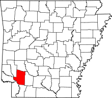 | |
| Towns | ||
| Unincorporated communities | ||
| Footnotes | ‡This populated place also has portions in an adjacent county or counties | |
Municipalities and communities of Howard County, Arkansas, United States | ||
|---|---|---|
| Cities | 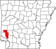 | |
| Town | ||
| Unincorporated communities | ||
| Ghost towns | ||
This article is issued from
Wikipedia.
The text is licensed under Creative Commons - Attribution - Sharealike.
Additional terms may apply for the media files.