Sarata
| Sarata Сарата | |
|---|---|
| town | |
 | |
 Sarata  Sarata | |
| Coordinates: 46°01′23.5″N 29°39′47.3″E / 46.023194°N 29.663139°E | |
| Country |
|
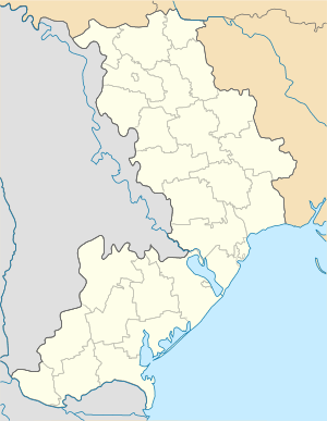
| Oblast |
|
| Raion | Sarata Raion |
| Population (2001) | |
| • Total | 5,200 |
| Time zone | UTC+2 (EET) |
| • Summer (DST) | UTC+3 (EEST) |
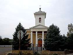
Sarata (Ukrainian, Bulgarian, and Russian: Сарата; Romanian: Sărata; ) is an urban-type settlement in Odessa Oblast (region) of south-western Ukraine. It is the administrative center of Sarata Raion (district), and is part of the Bessarabian historic district of Budjak. Population: 4,326 (2015 est.)[1]
In 2001 the estimated population was around 5,200. The town dates to 1822. Much of it is filled with crop fields and abandoned military bases. Many people here own their own farm animals although you would not call them farmers. Much of the community is modernized and still growing. The community holds many celebrations and parades, especially during the spring/summer time. Being only two hours away from the city, it is a convenient way to spend your summer relaxing.
Its name means "salty" in Romanian and is derived from the Sarata River, which flows through the town. A literal interpretation of Sărata in Romanian is the salted [female] one .
In spring of 1822 a group of Germans travelled to the lands. In the group of settlers were 63 families and 9 single people without family; they were led by Pastor Ignaz Lindl. They set up a colony around a well with an underground spring. They named the camp Sarata - just like the river that ran through the lands. Around the well the group built small houses, tents, and barns. Being a source of life, the well was included into the coat of arms of Sarata at the time.
Notable persons born in Sarata
- Christian Fiess (1910-2001), teacher and chairman of the Landsmannschaft der Bessarabiendeutschen
- Immanuel Winkler (1886-1932), born in Sarata, priest of 1911-1918 in Hoffnungstal and chairman of the main committee of the "All Russian association of Russian citizens of German nationality"
References
- ↑ "Чисельність наявного населення України (Actual population of Ukraine)" (PDF) (in Ukrainian). State Statistics Service of Ukraine. Retrieved 1 July 2016.
| Raions | |||||
|---|---|---|---|---|---|
| Cities |
| ||||
| |||||