Santa Maria Maggiore, Piedmont
| Santa Maria Maggiore | |
|---|---|
| Comune | |
| Comune di Santa Maria Maggiore | |
 Santa Maria Maggiore Location of Santa Maria Maggiore in Italy | |
| Coordinates: 46°8′N 8°28′E / 46.133°N 8.467°ECoordinates: 46°8′N 8°28′E / 46.133°N 8.467°E | |
| Country | Italy |
| Region | Piedmont |
| Province | Province of Verbano-Cusio-Ossola (VB) |
| Area | |
| • Total | 53.2 km2 (20.5 sq mi) |
| Elevation | 816 m (2,677 ft) |
| Population (Dec. 2004) | |
| • Total | 1,236 |
| • Density | 23/km2 (60/sq mi) |
| Demonym(s) | Maggioritani |
| Time zone | UTC+1 (CET) |
| • Summer (DST) | UTC+2 (CEST) |
| Postal code | 28038 |
| Dialing code | 0324 |
| Website | Official website |
Santa Maria Maggiore is a comune (municipality) in the Province of Verbano-Cusio-Ossola in the Italian region Piedmont, located about 130 kilometres (81 mi) northeast of Turin and about 25 kilometres (16 mi) north of Verbania, on the border with Switzerland. As of 31 December 2004, it had a population of 1,236 and an area of 53.2 square kilometres (20.5 sq mi).[1]
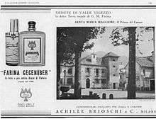
Santa Maria Maggiore 1928
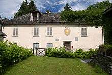
Casa Farina located in Via Gian Maria Farina
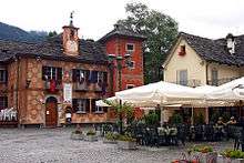
Piazza Risorgimento with the ex seat of the municipality
Santa Maria Maggiore borders the following municipalities: Campo (Vallemaggia) (Switzerland), Craveggia, Druogno, Malesco, Masera, Montecrestese, Toceno, Trontano, Vergeletto (Switzerland).
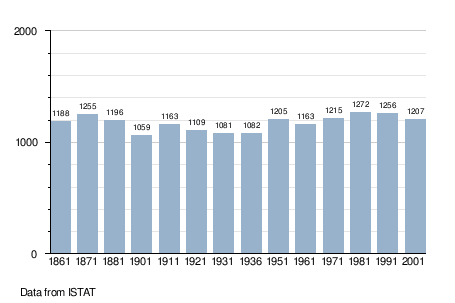
Demographic evolution
References
External links
| Wikimedia Commons has media related to: |

This article is issued from
Wikipedia.
The text is licensed under Creative Commons - Attribution - Sharealike.
Additional terms may apply for the media files.