Sand Ridge, West Virginia
| Sand Ridge, West Virginia | |
|---|---|
| Unincorporated community | |
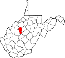
 Sand Ridge Location within the state of West Virginia  Sand Ridge Sand Ridge (the US) | |
| Coordinates: 38°48′6″N 81°4′0″W / 38.80167°N 81.06667°WCoordinates: 38°48′6″N 81°4′0″W / 38.80167°N 81.06667°W | |
| Country | United States |
| State | West Virginia |
| County | Calhoun |
| Time zone | UTC-5 (Eastern (EST)) |
| • Summer (DST) | UTC-4 (EDT) |
Sand Ridge (also Sandridge) is an unincorporated community in Calhoun County, West Virginia, United States. It lies along U.S. Route 33 to the south of the town of Grantsville, the county seat of Calhoun County.[1] Its elevation is 1,168 feet (356 m).[2]
The community was named for the sandy character of the soil in the area. It is the site of the Round Methodist Church on the National Register, built round by the Poling family "so the devil would have no place to hide." Its post office is now closed.[3]
See also
References
- ↑ Rand McNally. The Road Atlas '04. Chicago: Rand McNally, 2004, p. 112.
- ↑ U.S. Geological Survey Geographic Names Information System: Sand Ridge, West Virginia, Geographic Names Information System, 1980-06-12. Accessed 2008-01-17.
- ↑ Kenny, Hamill (1945). West Virginia Place Names: Their Origin and Meaning, Including the Nomenclature of the Streams and Mountains. Piedmont, WV: The Place Name Press. p. 553.
This article is issued from
Wikipedia.
The text is licensed under Creative Commons - Attribution - Sharealike.
Additional terms may apply for the media files.