San Pedro, New Mexico
| San Pedro, New Mexico | |
|---|---|
| Unincorporated community | |
 San Pedro | |
| Coordinates: 35°14′23″N 106°12′34″W / 35.23972°N 106.20944°WCoordinates: 35°14′23″N 106°12′34″W / 35.23972°N 106.20944°W | |
| Country | United States |
| State | New Mexico |
| County | Santa Fe |
| Area[1] | |
| • Total | 9.764 sq mi (25.29 km2) |
| • Land | 9.764 sq mi (25.29 km2) |
| • Water | 0 sq mi (0 km2) |
| Elevation | 6,883 ft (2,098 m) |
| Population (2010)[1] | |
| • Total | 184 |
| • Density | 19/sq mi (7.3/km2) |
| Time zone | UTC-7 (Mountain (MST)) |
| • Summer (DST) | UTC-6 (MDT) |
| Area code(s) | 505 |
| GNIS feature ID | 899899[2] |
San Pedro is an unincorporated community and census-designated place in Santa Fe County, New Mexico, United States. Its population was 184 as of the 2010 census.[1] New Mexico State Road 344 passes through the community.
Geography
San Pedro is located at 35°14′23″N 106°12′34″W / 35.2397644°N 106.2094684°W.[2] According to the U.S. Census Bureau, the community has an area of 9.764 square miles (25.29 km2), all of it land.[1]
References
- 1 2 3 4 "2010 Census Gazetteer Files - Places: New Mexico". U.S. Census Bureau. Retrieved December 31, 2016.
- 1 2 "San Pedro". Geographic Names Information System. United States Geological Survey.
Municipalities and communities of Santa Fe County, New Mexico, United States | ||
|---|---|---|
| Cities | 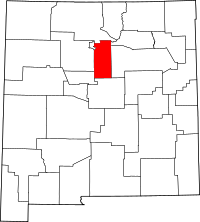 | |
| Town | ||
| CDPs |
| |
| Unincorporated communities | ||
| Indian reservation | ||
| Footnotes | ‡This populated place also has portions in an adjacent county or counties | |
This article is issued from
Wikipedia.
The text is licensed under Creative Commons - Attribution - Sharealike.
Additional terms may apply for the media files.