San Manuel Airport
| San Manuel Airport | |||||||||||
|---|---|---|---|---|---|---|---|---|---|---|---|
 | |||||||||||
| Summary | |||||||||||
| Airport type | Public | ||||||||||
| Owner | BHP | ||||||||||
| Operator | Pinal County, Arizona | ||||||||||
| Serves | San Manuel, Arizona | ||||||||||
| Elevation AMSL | 3,272 ft / 997 m | ||||||||||
| Coordinates | 32°38′11″N 110°38′50″W / 32.63639°N 110.64722°WCoordinates: 32°38′11″N 110°38′50″W / 32.63639°N 110.64722°W | ||||||||||
| Map | |||||||||||
 E77  E77 | |||||||||||
| Runways | |||||||||||
| |||||||||||
| Statistics (2017) | |||||||||||
| |||||||||||
|
Source: Federal Aviation Administration | |||||||||||
San Manuel Airport (FAA LID: E77), known as San Manuel Ray Blair Airport, is a privately owned, public-use airport owned by BHP, the same owners of the San Manuel Copper Mine, on lease to Pinal County. The airport is located 2.3 miles (2.0 nmi; 3.7 km) northwest of the central business district of San Manuel, a city in Pinal County, Arizona, United States and 40 miles (35 nmi; 64 km) northeast of Tucson International Airport.[1]
Although most U.S. airports use the same three-letter location identifier for the FAA, IATA, and ICAO San Manuel Airport is only assigned E77 by the FAA.[2]
Facilities and aircraft
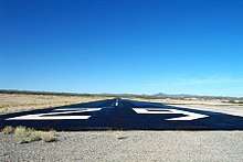
San Manuel Airport covers an area of 54 acres (22 ha) at an elevation of 3,272 ft (997 m) above mean sea level. It has one runway:
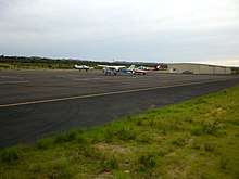
For the 12-month period ending April 19, 2017, the airport had 14,010 aircraft operations, an average of 38 per day: 100% general aviation. At that time there were 20 aircraft based at this airport: 75% single-engine, 20% ultralight, no multi-engine, no jet, and 5% helicopters.
References
- ↑ "AirportIQ 5010". www.gcr1.com. Retrieved 2018-05-09.
- ↑ "E77 - San Manuel, AZ, US - Airport - Great Circle Mapper". www.gcmap.com. Retrieved 2018-05-09.
- ↑ "AirNav: E77 - San Manuel Airport". www.airnav.com. Retrieved 2018-05-09.
External links
- San Manuel Airport (E77) at Arizona DOT airport directory
- San Manuel Airport at San Manuel tourism
- FAA Terminal Procedures for E77, effective October 11, 2018
- Resources for this airport:
- FAA airport information for E77
- AirNav airport information for KE77
- FlightAware airport information and live flight tracker
- NOAA/NWS latest weather observations
- SkyVector aeronautical chart, Terminal Procedures