San Francisquito Canyon
Coordinates: 34°25′37″N 118°34′31″W / 34.42694°N 118.57536°W
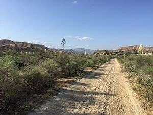
San Francisquito Canyon is a canyon created through erosion of the Sierra Pelona Mountains by the San Francisquito Creek, in Los Angeles County, Southern California.[1]
Geography
The canyon cuts through the Sierra Pelona Mountains, which are central part of the Transverse Ranges system of California. At the San Francisquito Canyon head is the San Francisquito Pass, which the early routes between Los Angeles and the San Joaquin Valley crossed. The canyon grows wider as it approaches the Santa Clarita Valley.
The middle and upper portions of this canyon fall within the Angeles National Forest.
History

Mining
San Francisquito Canyon was the site of placer mining for gold by Spanish missionaries from the San Fernando and San Buenaventura Missions, and later by Mexican Californios. Their activity stopped in 1848, when the gold discovery at Sutter's Mill started the California Gold Rush. Placer mining later occurred in the canyon into at least the latter 19th-century.
St. Francis Dam
Between 1924 and 1928 the canyon was the site of the St. Francis Dam. At 11:57PM on March 12, 1928, the dam catastrophically failed, and the resulting flood took the lives of as many as 400 people.[2][3] The collapse of the St. Francis Dam is considered to be one of the worst American civil engineering disasters of the 20th century and remains the second-greatest loss of life in California's history, after the 1906 San Francisco earthquake and fire. The ruins of this disaster can still be seen today.
Roads

Since 1820, San Francisquito Canyon and San Francisquito Pass were part of the original route of the El Camino Viejo. From 1854, the wagon route of the Stockton - Los Angeles Road followed its course as did the Butterfield Overland Mail in California from 1858-1861. This Tejon Pass Route and the Tehachapi or Midway Route (first followed by the Southern Pacific Railroad), remained the major north south wagon and later automobile routes to the San Joaquin Valley until the construction of the more direct Ridge Route in 1915.[4]
Today, a two-lane road named after the canyon itself connects Santa Clarita to the mountain communities of Green Valley and Elizabeth Lake. It roughly parallel the river's course between San Francisquito Pass and its southern terminus in northern Santa Clarita Valley.
See also
- San Francisquito Formation
- Castaic Creek - a neighboring stream
- Dry Canyon Reservoir - a nearby reservoir completed in 1912
References
- ↑ U.S. Geological Survey Geographic Names Information System: San Francisquito Canyon
- ↑ Stansell, Ann (August 2014). Memorialization and Memory of Southern California's St. Francis Dam Disaster of 1928. California State University, Northridge (Thesis).
- ↑ Stansell, Ann C. (February 2014). "Roster of St. Francis Dam Disaster Victims". Santa Clarita Valley History In Pictures.
- ↑ Scott, Harrison Irving, Ridge Route: The Road That United California. Torrance, California: Harrison Irving Scott. 2003, ISBN 0-615-12000-8. p.29
External links
![]()