Salsbruket
| Salsbruket | |
|---|---|
| Village | |
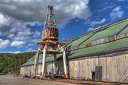 View of the old lumber mill | |
 Salsbruket Location of the village  Salsbruket Salsbruket (Norway) | |
| Coordinates: 64°48′03″N 11°51′50″E / 64.8008°N 11.8639°ECoordinates: 64°48′03″N 11°51′50″E / 64.8008°N 11.8639°E | |
| Country | Norway |
| Region | Central Norway |
| County | Trøndelag |
| District | Namdalen |
| Municipality | Nærøy |
| Elevation[1] | 7 m (23 ft) |
| Time zone | UTC+01:00 (CET) |
| • Summer (DST) | UTC+02:00 (CEST) |
| Post Code | 7960 Salsbruket |
Salsbruket is a village in Nærøy municipality in Trøndelag county, Norway. The village is located at the end of the Oppløyfjorden, at the mouth of the river Oppløyelva. A sawmill lies in the eastern part of the village, the Oplø area in the center, and Langnes in the western part of the village. Salsbruket Chapel is located in the central part of Oplø.[2]
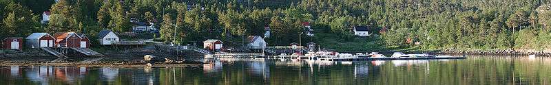
Langnes Harbor
References
- ↑ "Salsbruket, Nærøy (Trøndelag)". yr.no. Retrieved 2018-05-02.
- ↑ Thorsnæs, Geir, ed. (2015-12-19). "Salsbruket". Store norske leksikon (in Norwegian). Kunnskapsforlaget. Retrieved 2018-05-02.
This article is issued from
Wikipedia.
The text is licensed under Creative Commons - Attribution - Sharealike.
Additional terms may apply for the media files.