Sainte-Marguerite-sur-Fauville
| Sainte-Marguerite-sur-Fauville | ||
|---|---|---|
| ||
 Sainte-Marguerite-sur-Fauville Location within Normandy region  Sainte-Marguerite-sur-Fauville | ||
| Coordinates: 49°40′12″N 0°36′12″E / 49.67°N 0.6033°ECoordinates: 49°40′12″N 0°36′12″E / 49.67°N 0.6033°E | ||
| Country | France | |
| Region | Normandy | |
| Department | Seine-Maritime | |
| Arrondissement | Le Havre | |
| Canton | Saint-Valery-en-Caux | |
| Area1 | 3.16 km2 (1.22 sq mi) | |
| Population (2009)2 | 254 | |
| • Density | 80/km2 (210/sq mi) | |
| Time zone | UTC+1 (CET) | |
| • Summer (DST) | UTC+2 (CEST) | |
| INSEE/Postal code | 76607 /76640 | |
| Elevation |
114–139 m (374–456 ft) (avg. 130 m or 430 ft) | |
|
1 French Land Register data, which excludes lakes, ponds, glaciers > 1 km2 (0.386 sq mi or 247 acres) and river estuaries. 2 Population without double counting: residents of multiple communes (e.g., students and military personnel) only counted once. | ||
Sainte-Marguerite-sur-Fauville is a former commune in the Seine-Maritime département in the Normandy region in northern France. On 1 January 2017, it was merged into the new commune Terres-de-Caux.[1]
Inhabitants are called Sainte-Margueritais (male) or Sainte-Margueritaises (female).[2]
Geography
A small farming village, in the Pays de Caux, situated 27 miles (43 km) northeast of Le Havre, to the north of the junction of the D109 and D50 roads.
Coat of arms
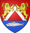 |
The arms of Sainte-Marguerite-sur-Fauville are blazoned : Gules, a chevronnel argent above 2 lions rampant guardant Or, and on a base azure 2 fesses wavy sable, over which a fish argent. |
Population
| 1962 | 1968 | 1975 | 1982 | 1990 | 1999 | 2006 | 2009 |
|---|---|---|---|---|---|---|---|
| 131 | 165 | 225 | 194 | 246 | 264 | 248 | 254 |
| Starting in 1962: Population without duplicates | |||||||
Places of interest
- A sandstone cross.
- The church of St.Marguerite, dating from the seventeenth century.
See also
References
- ↑ Arrêté préfectoral 12 September 2016 (in French)
- ↑ Commune de Sainte Marguerite sur Fauville (in French)
External links
| Wikimedia Commons has media related to Sainte-Marguerite-sur-Fauville. |
This article is issued from
Wikipedia.
The text is licensed under Creative Commons - Attribution - Sharealike.
Additional terms may apply for the media files.