Sainte-Hedwidge, Quebec
| Sainte-Hedwidge | |
|---|---|
| Municipality | |
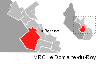 | |
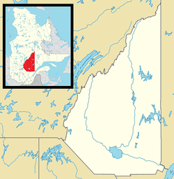 Sainte-Hedwidge Location in Saguenay–Lac-Saint-Jean Quebec. | |
| Coordinates: 48°29′N 72°21′W / 48.483°N 72.350°WCoordinates: 48°29′N 72°21′W / 48.483°N 72.350°W[1] | |
| Country |
|
| Province |
|
| Region | Saguenay–Lac-Saint-Jean |
| RCM | Le Domaine-du-Roy |
| Settled | 1887 |
| Constituted | March 10, 1909 |
| Government[2] | |
| • Mayor | Gilles Toulouse |
| • Federal riding | Roberval—Lac-Saint-Jean |
| • Prov. riding | Roberval |
| Area[2][3] | |
| • Total | 475.50 km2 (183.59 sq mi) |
| • Land | 459.25 km2 (177.32 sq mi) |
| Population (2011)[3] | |
| • Total | 824 |
| • Density | 1.8/km2 (5/sq mi) |
| • Pop (2006–11) |
|
| • Dwellings | 576 |
| Time zone | UTC−5 (EST) |
| • Summer (DST) | UTC−4 (EDT) |
| Postal code(s) | G0W 2R0 |
| Area code(s) | 418 and 581 |
Sainte-Hedwidge is a municipality in Quebec, Canada. The community is also known as Sainte-Hedwidge-de-Roberval.
Demographics
Population trend:[4]
- Population in 2011: 824 (2006 to 2011 population change: 0.5%)
- Population in 2006: 820
- Population in 2001: 843
- Population in 1996: 863
- Population in 1991: 879
Private dwellings occupied by usual residents: 362 (total dwellings: 576)
Mother tongue:[5]
- English as first language: 0%
- French as first language: 98.8%
- English and French as first language: 0%
- Other as first language: 1.2%
References
- ↑ Reference number 56194 of the Commission de toponymie du Québec (in French)
- 1 2 Ministère des Affaires municipales, des Régions et de l'Occupation du territoire - Répertoire des municipalités: Sainte-Hedwidge
- 1 2 "Sainte-Hedwidge census profile". 2011 Census data. Statistics Canada. Retrieved 2010-12-06.
- ↑ Statistics Canada: 1996, 2001, 2006, 2011 census
- ↑ "Sainte-Hedwidge community profile". 2006 Census data. Statistics Canada. Retrieved 2010-12-06.
Adjacent Municipal Subdivisions | ||||||||||
|---|---|---|---|---|---|---|---|---|---|---|
| ||||||||||
| Cities & Towns | |
|---|---|
| Municipalities | |
| Parishes | |
| Villages | |
| Unorganized territories | |
| |
This article is issued from
Wikipedia.
The text is licensed under Creative Commons - Attribution - Sharealike.
Additional terms may apply for the media files.