Saint-Prime, Quebec
| Saint-Prime | |
|---|---|
| Municipality | |
 The church of Saint-Prime | |
| Motto(s): Je cultive, Dieu fait croître ("I cultivate, God makes it grow") | |
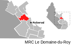 | |
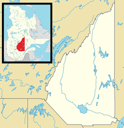 Saint-Prime Location in Saguenay–Lac-Saint-Jean Quebec | |
| Coordinates: 48°35′N 72°20′W / 48.58°N 72.33°WCoordinates: 48°35′N 72°20′W / 48.58°N 72.33°W[1] | |
| Country |
|
| Province |
|
| Region | Saguenay–Lac-Saint-Jean |
| RCM | Le Domaine-du-Roy |
| Settled | 1862 |
| Constituted | June 29, 1968 |
| Government[2] | |
| • Mayor | Bernard Généreux |
| • Federal riding | Lac-Saint-Jean |
| • Prov. riding | Roberval |
| Area[2][3] | |
| • Total | 160.70 km2 (62.05 sq mi) |
| • Land | 147.16 km2 (56.82 sq mi) |
| Population (2011)[3] | |
| • Total | 2,758 |
| • Density | 18.7/km2 (48/sq mi) |
| • Pop (2006–11) |
|
| • Dwellings | 1,216 |
| Time zone | UTC−5 (EST) |
| • Summer (DST) | UTC−4 (EDT) |
| Postal code(s) | G8J 1T2 |
| Area code(s) | 418 and 581 |
| Website |
www |
Saint-Prime is a municipality in Quebec, Canada, located within the regional county municipality of Le Domaine-du-Roy. The municipality had a population of 2,758 as of the Canada 2011 Census, and a land area of 147.16 km2.
Demographics
Population trend:[4]
- Population in 2011: 2758 (2006 to 2011 population change: 3.6%)
- Population in 2006: 2661
- Population in 2001: 2702
- Population in 1996: 2685
- Population in 1991: 2522
Private dwellings occupied by usual residents: 1,094 (total dwellings: 1,216)
Mother tongue:[5]
- English as first language: 0%
- French as first language: 98.9%
- English and French as first language: 0%
- Other as first language: 1.1%
Climate
Saint-Prime has a humid continental climate[6] that is some way above the subarctic classification due to its warm summers. Winters, however, are very cold and the seasonal differences are severe, although not extreme by Canadian or Quebec standards. Precipitation levels are high, bringing lots of snowfall in winter, but are by no means extreme compared to adjacent areas.
| Climate data for Saint-Prime | |||||||||||||
|---|---|---|---|---|---|---|---|---|---|---|---|---|---|
| Month | Jan | Feb | Mar | Apr | May | Jun | Jul | Aug | Sep | Oct | Nov | Dec | Year |
| Record high °C (°F) | 14 (57) |
11 (52) |
17.5 (63.5) |
29 (84) |
34 (93) |
37 (99) |
36.5 (97.7) |
34.5 (94.1) |
35.5 (95.9) |
25.5 (77.9) |
21 (70) |
11.5 (52.7) |
37 (99) |
| Average high °C (°F) | −10.1 (13.8) |
−7.7 (18.1) |
−1.0 (30.2) |
7.7 (45.9) |
16.6 (61.9) |
22.2 (72) |
24.4 (75.9) |
23.3 (73.9) |
18.1 (64.6) |
10.1 (50.2) |
2.1 (35.8) |
−6.1 (21) |
8.2 (46.8) |
| Daily mean °C (°F) | −17.0 (1.4) |
−14.2 (6.4) |
−7.3 (18.9) |
2.3 (36.1) |
10.1 (50.2) |
15.9 (60.6) |
18.4 (65.1) |
17.1 (62.8) |
12.1 (53.8) |
5.5 (41.9) |
−2.0 (28.4) |
−11.4 (11.5) |
2.5 (36.5) |
| Average low °C (°F) | −23.1 (−9.6) |
−20.8 (−5.4) |
−13.6 (7.5) |
−3.3 (26.1) |
3.5 (38.3) |
9.4 (48.9) |
12.3 (54.1) |
10.9 (51.6) |
6.8 (44.2) |
0.9 (33.6) |
−6.0 (21.2) |
−16.7 (1.9) |
−3.3 (26.1) |
| Record low °C (°F) | −44.5 (−48.1) |
−41.5 (−42.7) |
−37.5 (−35.5) |
−27 (−17) |
−7.5 (18.5) |
−3.5 (25.7) |
2 (36) |
−1 (30) |
−7 (19) |
−10 (14) |
−26.5 (−15.7) |
−44.5 (−48.1) |
−44.5 (−48.1) |
| Average rainfall mm (inches) | 55.3 (2.177) |
46.1 (1.815) |
50.0 (1.969) |
57.7 (2.272) |
65.4 (2.575) |
75.9 (2.988) |
118.3 (4.657) |
79.2 (3.118) |
84.2 (3.315) |
64.3 (2.531) |
72.7 (2.862) |
64.2 (2.528) |
833.2 (32.803) |
| Source: [7] | |||||||||||||
References
- ↑ Reference number 57543 of the Commission de toponymie du Québec (in French)
- 1 2 Ministère des Affaires municipales, des Régions et de l'Occupation du territoire - Répertoire des municipalités: Saint-Prime
- 1 2 "Saint-Prime census profile". 2011 Census data. Statistics Canada. Retrieved 2010-12-02.
- ↑ Statistics Canada: 1996, 2001, 2006, 2011 census
- ↑ "Saint-Prime community profile". 2006 Census data. Statistics Canada. Retrieved 2010-12-02.
- ↑ "St. Prime, Quebec Climate Summary". Weatherbase. Retrieved 15 June 2015.
- ↑ "St. Prime Quebec Temperature Averages". Weatherbase. Retrieved 15 June 2015.
External links

Places adjacent to Saint-Prime, Quebec | |
|---|---|
| Cities & Towns | |
|---|---|
| Municipalities | |
| Parishes | |
| Villages | |
| Unorganized territories | |
| |
This article is issued from
Wikipedia.
The text is licensed under Creative Commons - Attribution - Sharealike.
Additional terms may apply for the media files.