Saint-Michel-des-Saints Aerodrome
| Saint-Michel-des-Saints Aerodrome | |||||||||||
|---|---|---|---|---|---|---|---|---|---|---|---|
.jpg) view on St-Michel-des-saint airport (CSM5) | |||||||||||
| Summary | |||||||||||
| Airport type | Public | ||||||||||
| Operator | Municipalité de Saint-Michel-des-Saints | ||||||||||
| Location | Saint-Michel-des-Saints, Quebec | ||||||||||
| Time zone | EST (UTC−05:00) | ||||||||||
| • Summer (DST) | EDT (UTC−04:00) | ||||||||||
| Elevation AMSL | 1,372 ft / 418 m | ||||||||||
| Coordinates | 46°40′51″N 073°59′37″W / 46.68083°N 73.99361°WCoordinates: 46°40′51″N 073°59′37″W / 46.68083°N 73.99361°W | ||||||||||
| Map | |||||||||||
 CSM5 Location in Quebec | |||||||||||
| Runways | |||||||||||
| |||||||||||
Saint-Michel-des-Saints Aerodrome, (TC LID: CSM5), is located 3 nautical miles (5.6 km; 3.5 mi) west of Saint-Michel-des-Saints, Quebec, Canada.
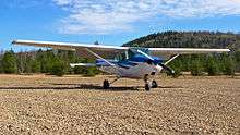
Cessna 172 on ground at St-Michel-des-Saints
References
- ↑ Canada Flight Supplement. Effective 0901Z 19 July 2018 to 0901Z 13 September 2018.
- ↑ Synoptic/Metstat Station Information
| By name | |
|---|---|
| By location indicator | |
| By province/territory | |
| By area | |
| National Airports System | |
| Related | |
| |
This article is issued from
Wikipedia.
The text is licensed under Creative Commons - Attribution - Sharealike.
Additional terms may apply for the media files.