Saint-Maurice-sur-Dargoire
| Saint-Maurice-sur-Dargoire | ||
|---|---|---|
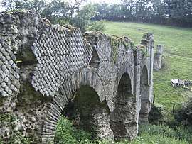 Roman Aqueduct of the Gier: The Bridge of Granges | ||
| ||
 Saint-Maurice-sur-Dargoire Location within Auvergne-Rhône-Alpes region  Saint-Maurice-sur-Dargoire | ||
| Coordinates: 45°34′59″N 4°37′55″E / 45.5831°N 4.6319°ECoordinates: 45°34′59″N 4°37′55″E / 45.5831°N 4.6319°E | ||
| Country | France | |
| Region | Auvergne-Rhône-Alpes | |
| Department | Rhône | |
| Arrondissement | Villefranche-sur-Saône | |
| Canton | Mornant | |
| Area1 | 16.27 km2 (6.28 sq mi) | |
| Population (2006)2 | 2,166 | |
| • Density | 130/km2 (340/sq mi) | |
| Time zone | UTC+1 (CET) | |
| • Summer (DST) | UTC+2 (CEST) | |
| INSEE/Postal code | 69228 /69440 | |
| Elevation |
204–535 m (669–1,755 ft) (avg. 463 m or 1,519 ft) | |
|
1 French Land Register data, which excludes lakes, ponds, glaciers > 1 km2 (0.386 sq mi or 247 acres) and river estuaries. 2 Population without double counting: residents of multiple communes (e.g., students and military personnel) only counted once. | ||
.svg.png)
Saint-Maurice-sur-Dargoire is a former commune in the Rhône department in eastern France. On 1 January 2017, it was merged into the new commune Chabanière.[1]
See also
References
- ↑ Arrêté préfectoral 5 October 2016 (in French)
| Wikimedia Commons has media related to Saint-Maurice-sur-Dargoire. |
This article is issued from
Wikipedia.
The text is licensed under Creative Commons - Attribution - Sharealike.
Additional terms may apply for the media files.