Sai Wan Ho station
Sai Wan Ho 西灣河 | ||||||||||||||||||||||||||||||||||||||||||||||||||||||||||||||||||||||||||||||||||||
|---|---|---|---|---|---|---|---|---|---|---|---|---|---|---|---|---|---|---|---|---|---|---|---|---|---|---|---|---|---|---|---|---|---|---|---|---|---|---|---|---|---|---|---|---|---|---|---|---|---|---|---|---|---|---|---|---|---|---|---|---|---|---|---|---|---|---|---|---|---|---|---|---|---|---|---|---|---|---|---|---|---|---|---|---|
| MTR rapid transit station | ||||||||||||||||||||||||||||||||||||||||||||||||||||||||||||||||||||||||||||||||||||
 Platform 1 | ||||||||||||||||||||||||||||||||||||||||||||||||||||||||||||||||||||||||||||||||||||
| Chinese name | ||||||||||||||||||||||||||||||||||||||||||||||||||||||||||||||||||||||||||||||||||||
| Traditional Chinese | 西灣河 | |||||||||||||||||||||||||||||||||||||||||||||||||||||||||||||||||||||||||||||||||||
| Simplified Chinese | 西湾河 | |||||||||||||||||||||||||||||||||||||||||||||||||||||||||||||||||||||||||||||||||||
| Cantonese Yale | Sāiwāanhó | |||||||||||||||||||||||||||||||||||||||||||||||||||||||||||||||||||||||||||||||||||
| Literal meaning | Western bay river | |||||||||||||||||||||||||||||||||||||||||||||||||||||||||||||||||||||||||||||||||||
| ||||||||||||||||||||||||||||||||||||||||||||||||||||||||||||||||||||||||||||||||||||
| General information | ||||||||||||||||||||||||||||||||||||||||||||||||||||||||||||||||||||||||||||||||||||
| Location |
Near Tai On Building, Shau Kei Wan Road, Sai Wan Ho Eastern District, Hong Kong | |||||||||||||||||||||||||||||||||||||||||||||||||||||||||||||||||||||||||||||||||||
| Coordinates | 22°16′54″N 114°13′21″E / 22.2816°N 114.2224°ECoordinates: 22°16′54″N 114°13′21″E / 22.2816°N 114.2224°E | |||||||||||||||||||||||||||||||||||||||||||||||||||||||||||||||||||||||||||||||||||
| Operated by | MTR Corporation | |||||||||||||||||||||||||||||||||||||||||||||||||||||||||||||||||||||||||||||||||||
| Line(s) | ||||||||||||||||||||||||||||||||||||||||||||||||||||||||||||||||||||||||||||||||||||
| Platforms | 2 (split level side platforms) | |||||||||||||||||||||||||||||||||||||||||||||||||||||||||||||||||||||||||||||||||||
| Connections | Bus, public light bus, tram, ferry | |||||||||||||||||||||||||||||||||||||||||||||||||||||||||||||||||||||||||||||||||||
| Construction | ||||||||||||||||||||||||||||||||||||||||||||||||||||||||||||||||||||||||||||||||||||
| Structure type | Underground | |||||||||||||||||||||||||||||||||||||||||||||||||||||||||||||||||||||||||||||||||||
| Platform levels | 2 | |||||||||||||||||||||||||||||||||||||||||||||||||||||||||||||||||||||||||||||||||||
| Disabled access | Yes | |||||||||||||||||||||||||||||||||||||||||||||||||||||||||||||||||||||||||||||||||||
| Other information | ||||||||||||||||||||||||||||||||||||||||||||||||||||||||||||||||||||||||||||||||||||
| Station code | SWH | |||||||||||||||||||||||||||||||||||||||||||||||||||||||||||||||||||||||||||||||||||
| History | ||||||||||||||||||||||||||||||||||||||||||||||||||||||||||||||||||||||||||||||||||||
| Opened |
| |||||||||||||||||||||||||||||||||||||||||||||||||||||||||||||||||||||||||||||||||||
| Services | ||||||||||||||||||||||||||||||||||||||||||||||||||||||||||||||||||||||||||||||||||||
|
| ||||||||||||||||||||||||||||||||||||||||||||||||||||||||||||||||||||||||||||||||||||
| ||||||||||||||||||||||||||||||||||||||||||||||||||||||||||||||||||||||||||||||||||||
| Location | ||||||||||||||||||||||||||||||||||||||||||||||||||||||||||||||||||||||||||||||||||||
|
Sai Wan Ho Location within the MTR system | ||||||||||||||||||||||||||||||||||||||||||||||||||||||||||||||||||||||||||||||||||||
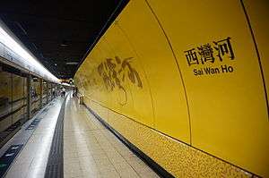
Sai Wan Ho (Chinese: 西灣河; Cantonese Yale: Sāiwāanhó) is a station in Sai Wan Ho on the Hong Kong MTR Island Line. It was opened on 31 May 1985. It is located under Shau Kei Wan Road in Sai Wan Ho in Eastern District.
Station layout
The platforms of Sai Wan Ho station are constructed in a stacked arrangement, with platform 2 above platform 1.
| G | Ground level | Exits |
| C | Concourse | Customer Service, MTRShops |
| Vending machines, ATM | ||
| UP Platform |
Side platform, doors will open on the right | |
| Platform 2 | ← Island line towards Kennedy Town (Tai Koo) | |
| LP Platform |
Side platform, doors will open on the left | |
| Platform 1 | Island line towards Chai Wan (Shau Kei Wan) → | |
Entrances and exits
- A: Tai On Street

- B: Shau Kei Wan Road[2]
Transport connections
Minibus routes (Exit A)
- Route 50 to Yiu Tung Estate (Circular)
- Route 65 to Pamela Youde Nethersole Eastern Hospital
Ferry services (Exit A)
Ferry services to Tung Lung Chau, Lei Yue Mun and Kwun Tong in Sai Wan Ho are provided at the pier along Tai On Street.
Bus routes (Exit B)
To reach the bus stop, cross the road by using the footbridge.
Citybus
- Route A12 to Airport (Ground Transportation Centre)
- Route A12 (Special despatch) to Airport (via Cathay City / CAD Headquarters)
- Route N8X (Night time service) to Central (Macau Ferry)
- Route N122 (Night time service), 102 and 102P to Mei Foo
- Route 85 to Siu Sai Wan (Island Resort) (Circular)
- Route 85A to Braemar Hill
First Bus
- Route 2 and 720 to Central (Macau Ferry)
- Route 2X to Wan Chai North
- Route 14 to Sai Wan Ho
- Route 18X to Kennedy Town (Belcher Bay)
- Route 82 to North Point Ferry Pier
- Route 106 and 106P to Wong Tai Sin
- Route 682 to Ma On Shan (Lee On Estate)
- Route 694 to Tiu Keng Leng Station
- Route 720 (Special despatch) to Central (Gilman Street)
- Route 720A to Grand Promenade (Circular)
Tram services (Exit B)
- 08W Holy Cross Path Stop (Westbound)
- 93E Tai On Street Stop (Eastbound)
References
| Wikimedia Commons has media related to Sai Wan Ho (MTR). |
- ↑ "Sai Wan Ho Station layout" (PDF). MTR Corporation. Retrieved 31 July 2014.
- ↑ "Sai Wan Ho Station street map" (PDF). MTR Corporation. Retrieved 31 July 2014.
This article is issued from
Wikipedia.
The text is licensed under Creative Commons - Attribution - Sharealike.
Additional terms may apply for the media files.