Sadiya
| Sadiya Sadia | |
|---|---|
| town | |
| Nickname(s): Starting point of Assam | |
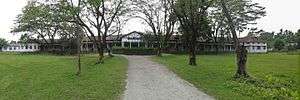
 Sadiya Location in Assam, India  Sadiya Sadiya (India) | |
| Coordinates: 27°50′N 95°40′E / 27.83°N 95.67°ECoordinates: 27°50′N 95°40′E / 27.83°N 95.67°E | |
| Country |
|
| State | Assam |
| District | Tinsukia |
| Elevation | 123 m (404 ft) |
| Languages | |
| • Official | Assamese |
| Time zone | UTC+5:30 (IST) |
| Vehicle registration | AS 23 |
Sadiya xôdiya, meaning "land of rising sun") was the third capital of Chutia Kingdom established by the second Sutiya ruler Ratnadhwajpal in 1248 and remained as the capital till 1524.[1] Extensive remains of buildings and fortifications built during the rule of the Chutias near about Sadiya still point to the importance of the region in the past. Historically Sadiya included the entire districts of Lakhimpur, Dhemaji and Tinsukia and was dominated by the Chutia ethnic group before the first millennium. It was also the center of development of the Eastern form of Prakrit during both the Chutia and Ahom periods, which later gave rise to the modern form of Assamese.[2] It is located in the Tinsukia district of the Northeast Indian state of Assam. Its stands on a grassy plain, almost surrounded by forested Himalayan mountains, on the right bank of what is locally (but erroneously) considered the main stream of the Brahmaputra river. Sadiya is famous for a flower named satphul (the word means "blessing" or a "desert flower"), which is much like Jasmine.
Etymology
The word "Sadiya" is derived from the Deori-Chutia language and it stands for "land of rising sun". "Sa/Xa" means "Sun", "Di" meaning "water" and "Ya" meaning "land". There is a sloka in the 10th century Kalika purana which shows that the region had a very ancient origin. It reads,
“Sadiya Korjaku-Desha Chutika-Bansha Bhirmuka
Dhatu Dravya Tu Lebhe Na Hatwa Janpadanaya”— Kalika purana
According to another source, the Gauda ruler possibly Khesav Sen made friends with the Chutia king Ratnadhwajpal (Gaurinarayan) who sent one of his sons to that country for education. Unfortunately, the Chutia Prince died there and the corpse was sent to Gaurinarayan. At the time of the arrival of the corpse, Gaurinarayan was engaged in building a new city. He named the city Sadiya (sa "corpse", diya "given").[3] However, this source seems to be erroneous because the mention of Sadiya in Kalika Purana seems to occcur about 300 years prior to the said event.
History
According to mythology, Sadiya was the capital of the legendary king Bhirmuko which was sanskritised to Bhismak(whom the Chutiyas considers themselves as descendants of), but archeological evidence shows that this place was made a capital only during 7th-8th century. According to one source, the Chutias probably moved their capital from somewhere in Central Assam to Sadiya during 650 A.D from where a new line of kings starting from one named Assambhinna ruled the region. There are ruins of an old city known locally as Bhismaknagar which was probably built by the earlier Chutia kings. Sadiya was later rebuilt by Gaurinarayan, the second ruler of the medieval greater Chutiya dynasty during the mid 13th century and remained as the capital till the 16th century. Sadiya was the extreme north-east frontier station of British Raj, in the Lakhimpur district of Eastern Bengal and Assam regions. On the opposite bank is a railway station which used to connect with the Assam-Bengal line of that era. Sadiya had been garrisoned by detachments of native infantry and military police, and was the base of a chain of outposts. There had a bazaar, to which the hill-men beyond the frontier—Mishmis, Abors, and Khamtis—used to bring down rubber, wax, ivory, and musk, to barter for Cotton cloth, salt and metal goods. In 1943-44 there was a United States Army Air Force (USAAF) field at Sadiya which hosted the 89th Fighter Squadron of the 80th Group, headquartered at Nagaghuli, now Chabua Air Base of the Indian Air Force. Sadiya today serves as one of the district headquarters for Indian Red Cross.
In 1882 Francis Jack Needham was appointed Assistant Political Agent for the British authorities after having served in the region as an assistant Superintendent of Police since 1876. He finally retired from service in 1905 after spending his life exploring above the Brahmaputra river and writing a treatise on the grammar of Miri, Singpho, and Khamti languages. He was awarded the Gill memorial medal in 1887 and made a fellow of The Royal Geographical Society in 1889. His main purpose in life was exploration partly in order to try and discover the source of the Brahmaputra river. His award of the Gill memorial Medal and F.R.G.S. was for penetrating into the Zanjul Valley and into Tibet from Assam. Sadiya ancient name Sindhu khetra.
Geography
Sadiya is located at 27°50′N 95°40′E / 27.83°N 95.67°E.[4] It has an average elevation of 123 m (404 ft).
Sadiya is considered by some people as the widest point of any river all over the world at the point of creation of mighty river Brahmaputra with the joining of three rivers namely—Dihang River (Tsangpo, Siang, the main stream of Brahmaputra), Dibang River, and Lohit River.
Politics
Sadiya is part of Lakhimpur (Lok Sabha constituency). Name of the assembly constituency is 126-Sadiya LAC.
Sadiya is one of the three Sub-Divisions of Tinsukia District. Chapakhowa is the centre of Sadiya.[5]
See also
References
- ↑ (Col. Ved Prakash:912)
- ↑ (Yasmin Saikia:67)
- ↑ (Prakash 2007:267)
- ↑ Falling Rain Genomics, Inc - Sadiya
- ↑ "List of Parliamentary & Assembly Constituencies" (PDF). Assam. Election Commission of India. Archived from the original (PDF) on 2006-05-04. Retrieved 2008-10-06.
