Texas State Highway 72
| ||||||||||
|---|---|---|---|---|---|---|---|---|---|---|
 | ||||||||||
| Route information | ||||||||||
| Maintained by TxDOT | ||||||||||
| Length | 111.73 mi[1][nb 1] (179.82 km) | |||||||||
| Existed | 1923–present | |||||||||
| Major junctions | ||||||||||
| West end |
| |||||||||
|
| ||||||||||
| East end |
| |||||||||
| Location | ||||||||||
| Counties | McMullen, Live Oak, Bee, Karnes, DeWitt | |||||||||
| Highway system | ||||||||||
| ||||||||||

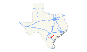
State Highway 72 (SH 72) is a Texas state highway that runs approximately 111 miles (179 km) from near Fowlerton to Cuero in South Texas.[1]
Route description
SH 72 begins in far western McMullen County, near the La Salle County line, at an intersection with SH 97 north of Fowlerton.[1][2] The highway has no major intersections until it intersects SH 16 north of Tilden.[3] The two routes run concurrently into Tilden, where SH 72 resumes its eastward path, passing south of Choke Canyon Reservoir and State Park before entering Live Oak County. The highway enters Three Rivers, where it intersects and runs concurrently with US 281 through the city center.[4] After separating from US 281, SH 72 takes a more northeasterly trajectory for the remainder of its journey. After crossing I-37 at the freeway's exit #69, it continues through rural Live Oak County and briefly passes through Bee County before entering Karnes County.[5] In Kenedy, SH 72 intersects US 181 and passes through the city's downtown along Main Street; SH 72's only business route is also in this city. To the east of the city, SH 72 intersects SH 239 and passes through Runge before entering DeWitt County.[6][7] The highway passes through Yorktown along that city's Main Street, intersecting SH 119. SH 72 intersects US 87 to the west of Cuero before it turns to the east and into the city. SH 72 ends at Alt. US 77 / US 87 / US 183 on the south side of Cuero.[1]
History
SH 72 was originally proposed on August 21, 1923 from Cuero to Carmine, absorbing previously designated SH 3B.[8] On March 17, 1924, it extended southwest to Yorktown.[9] On December 21, 1926, it extended to Karnes City.[10] On February 21, 1928, its south end was rerouted to Kenedy. On March 3, 1931, SH 72 Spur to Sweet Home was added, but was not part of the state highway system (it was added to the state highway system on March 16, 1937).[11][12] On May 15, 1934, SH 72 Bypass was designated in Yoakum. On November 24, 1936, its route had been readjusted, with the section north of Cuero transferred to US 77/SH 44 and SH 128.[13] On November 16, 1937, it extended to Three Rivers.[14] On September 26, 1939, a section was added from Kenedy to Cotulla, and everything north of Cuero was cancelled (as it was part of US 77). SH 72 Spur and SH 72 Bypass were renumbered Spur 27 (Sweet Home) and Loop 51 (Yoakum). On June 23, 1942, the section from Fowlerton to Three Rivers was either cancelled or transferred to Farm to Market Road 63.[15] On July 31, 1942, the section from Fowlerton to Cotulla was transferred to SH 97. On December 15, 1960, the section from Fowlerton to Three Rivers was transferred back to SH 72. On March 2, 1981, the section between Three Rivers and Tilden was relocated around the then-proposed Choke Canyon Reservoir, as the old route would be inundated by the Choke Canyon Reservoir. The section from the junction with US 87 in Cuero into the city was designated Farm to Market Road 3402 in 1977; this route was extended to the west to US 87 in 1983. FM 3402 was combined with SH 72 on March 31, 1994, completing the current route.[1][16]
SH 72 has seen increased traffic due to oil and gas exploration of the Eagle Ford Formation; recent counts have indicated that traffic on SH 72 exceeds that on US 87 around Cuero. As a result, TxDOT is considering the addition of shoulders to SH 72 in western DeWitt County.[17]
Business route
| |
|---|---|
| Location | Kenedy |
| Length | 1.096 mi[18] (1.764 km) |
| Existed | 1982 (as Spur 542)–present[18] |

SH 72 has one business route, Business SH 72-B in Kenedy, which is a former alignment of the state highway along Karnes Street through that city.[18] The route was designated as Spur 542 on April 20, 1982, when SH 72 was rerouted to use Main Street.[19] The route was changed to Business SH 72-B on June 21, 1990. The western end of the business route is at Bus. US 181, which was renumbered from Spur 259 the same day.[20]
Major intersections
| County | Location | mi[21][22][nb 1] | km | Destinations | Notes |
|---|---|---|---|---|---|
| McMullen | | 0.0 | 0.0 | Western terminus | |
| | 15.6 | 25.1 | West end of SH 16 concurrency | ||
| Tilden | 16.3 | 26.2 | East end of SH 16 concurrency | ||
| | 23.0 | 37.0 | |||
| | 24.2 | 38.9 | |||
| | 28.1 | 45.2 | |||
| Live Oak | | 32.1 | 51.7 | ||
| | 36.1 | 58.1 | |||
| Three Rivers | 39.1 | 62.9 | West end of US 281 concurrency | ||
| 39.8 | 64.1 | East end of US 281 concurrency | |||
| | 42.3 | 68.1 | |||
| | 44.5 | 71.6 | |||
| | 46.9 | 75.5 | |||
| Bee | Pawnee | 56.8 | 91.4 | ||
| 57.1 | 91.9 | ||||
| | 57.8 | 93.0 | |||
| Karnes | Zunkerville | 60.5 | 97.4 | ||
| | 64.0 | 103.0 | |||
| | 70.6 | 113.6 | |||
| Kenedy | 71.2 | 114.6 | |||
| 71.6 | 115.2 | ||||
| 72.0 | 115.9 | ||||
| 72.3 | 116.4 | ||||
| 72.4 | 116.5 | ||||
| 73.3 | 118.0 | ||||
| | 74.2 | 119.4 | |||
| Runge | 82.6 | 132.9 | |||
| DeWitt | Nordheim | 89.6 | 144.2 | ||
| | 94.7 | 152.4 | |||
| | 96.1 | 154.7 | |||
| Yorktown | 97.1 | 156.3 | |||
| 97.5 | 156.9 | ||||
| | 98.6 | 158.7 | |||
| | 109.0 | 175.4 | |||
| Cuero | 112.9 | 181.7 | Eastern terminus | ||
| 1.000 mi = 1.609 km; 1.000 km = 0.621 mi | |||||
Notes
References
- 1 2 3 4 5 Transportation Planning and Programming Division (n.d.). "State Highway No. 72". Highway Designation Files. Texas Department of Transportation. Retrieved November 2, 2012.
- ↑ Transportation Planning and Programming Division (2012). Texas County Mapbook (PDF) (Map) (2012 ed.). 1:120,000. Texas Department of Transportation. p. 378. OCLC 867856197. Retrieved November 3, 2012.
- ↑ Transportation Planning and Programming Division (2012). Texas County Mapbook (PDF) (Map) (2012 ed.). 1:120,000. Texas Department of Transportation. p. 408. OCLC 867856197. Retrieved November 3, 2012.
- ↑ Transportation Planning and Programming Division (2012). Texas County Mapbook (PDF) (Map) (2012 ed.). 1:120,000. Texas Department of Transportation. p. 438. OCLC 867856197. Retrieved November 3, 2012.
- ↑ Transportation Planning and Programming Division (2012). Texas County Mapbook (PDF) (Map) (2012 ed.). 1:120,000. Texas Department of Transportation. p. 437. OCLC 867856197. Retrieved November 3, 2012.
- ↑ Transportation Planning and Programming Division (2012). Texas County Mapbook (PDF) (Map) (2012 ed.). 1:120,000. Texas Department of Transportation. p. 436. OCLC 867856197. Retrieved November 3, 2012.
- ↑ Transportation Planning and Programming Division (2012). Texas County Mapbook (PDF) (Map) (2012 ed.). 1:120,000. Texas Department of Transportation. p. 466. OCLC 867856197. Retrieved November 3, 2012.
- ↑ (PDF) https://publicdocs.txdot.gov/minord/MinuteOrderDocLib/003676878.pdf. Missing or empty
|title=(help) - ↑ (PDF) https://publicdocs.txdot.gov/minord/MinuteOrderDocLib/003676885.pdf. Missing or empty
|title=(help) - ↑ (PDF) https://publicdocs.txdot.gov/minord/MinuteOrderDocLib/003676961.pdf. Missing or empty
|title=(help) - ↑ (PDF) https://publicdocs.txdot.gov/minord/MinuteOrderDocLib/003673894.pdf. Missing or empty
|title=(help) - ↑ (PDF) https://publicdocs.txdot.gov/minord/MinuteOrderDocLib/003673801.pdf. Missing or empty
|title=(help) - ↑ (PDF) https://publicdocs.txdot.gov/minord/MinuteOrderDocLib/003673888.pdf. Missing or empty
|title=(help) - ↑ (PDF) https://publicdocs.txdot.gov/minord/MinuteOrderDocLib/003673908.pdf. Missing or empty
|title=(help) - ↑ Transportation Planning and Programming Division (n.d.). "Farm to Market Road No. 63". Highway Designation Files. Texas Department of Transportation. Retrieved November 2, 2012.
- ↑ Transportation Planning and Programming Division (n.d.). "Farm to Market Road No. 3402". Highway Designation Files. Texas Department of Transportation. Retrieved November 2, 2012.
- ↑ Long, Sonny (November 18, 2011). "DeWitt County officials, residents discuss increased oil industry traffic, concerns". The Victoria Advocate. Retrieved November 3, 2012.
- 1 2 3 Transportation Planning and Programming Division (n.d.). "Business State Highway No. 72-B". Highway Designation Files. Texas Department of Transportation. Retrieved November 2, 2012.
- ↑ Transportation Planning and Programming Division (n.d.). "State Highway Spur No. 542". Highway Designation Files. Texas Department of Transportation. Retrieved November 2, 2012.
- ↑ Transportation Planning and Programming Division (n.d.). "State Highway Spur No. 259". Highway Designation Files. Texas Department of Transportation. Retrieved November 2, 2012.
- ↑ Google (November 2, 2012). "SH 72 Overview Map with Major Intersections: Jct. SH 97 to Jct. US 181" (Map). Google Maps. Google. Retrieved November 2, 2012.
- ↑ Google (November 2, 2012). "SH 72 Overview Map with Major Intersections: Jct. US 181 to Jct. US 183" (Map). Google Maps. Google. Retrieved November 2, 2012.