Rustad Knoll
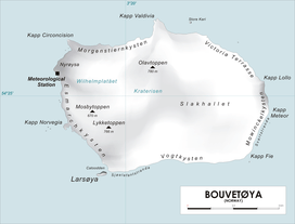
Map of Bouvetøya
Rustad Knoll (54°28′S 3°23′E / 54.467°S 3.383°ECoordinates: 54°28′S 3°23′E / 54.467°S 3.383°E) is a rounded, snow-topped elevation (365 m) which surmounts the south shore of the island of Bouvetøya immediately east of Cato Point. First charted in 1898 by a German expedition under carl Chun. [1]The knoll was recharted in December 1927 by the Norvegia expedition under Captain Harald Horntvedt. [2]They named it for Ditlef Rustad who was in charge of the biological research of the expedition.[3]
References
- ↑ "Prof. Dr. phil., Dr. med. h. c. Carl Chun". University of Leipzig. Retrieved October 1, 2016.
- ↑ "Norvegia I". polarhistorie.no. Retrieved October 1, 2016.
- ↑ "Norvegia-ekspedisjonene". Store norske leksikon. Retrieved October 1, 2016.
![]()
This article is issued from
Wikipedia.
The text is licensed under Creative Commons - Attribution - Sharealike.
Additional terms may apply for the media files.