Cato Point
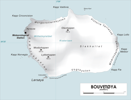
Map of Bouvetøya
Cato Point (54°28′S 3°22′E / 54.467°S 3.367°ECoordinates: 54°28′S 3°22′E / 54.467°S 3.367°E)is a headland forming the southwest extremity of Bouvet Island. It was first charted in 1898 by a German expedition under Carl Chun. The Norwegian expedition under Captain Harald Horntvedt made a landing here from the Norvegia in December 1927; they applied the name.[1][2]
References
- ↑ Susan Barr. "Bouvetøya". Store norske leksikon. Retrieved October 1, 2016.
- ↑ "Prof. Dr. phil., Dr. med. h. c. Carl Chun". University of Leipzig. Retrieved October 1, 2016.

This article is issued from
Wikipedia.
The text is licensed under Creative Commons - Attribution - Sharealike.
Additional terms may apply for the media files.