Roteck
| Roteck | |
|---|---|
 | |
| Highest point | |
| Elevation | 3,337 m (10,948 ft) |
| Prominence | 497 m (1,631 ft) |
| Isolation | 4.93 kilometres (3.06 mi) |
| Parent peak | Hohe Weiße (Hintere Schwärze) |
| Coordinates | 46°43′25″N 10°59′03″E / 46.72361°N 10.98417°ECoordinates: 46°43′25″N 10°59′03″E / 46.72361°N 10.98417°E |
| Geography | |
 Roteck Location in the Alps | |
| Location | South Tyrol, Italy |
| Parent range | Ötztal Alps |
| Climbing | |
| First ascent | 14 Jul 1872 by Theodor Petersen, Rochus Raffeiner, Illdefons Kobler |
| Easiest route | East ridge (UIAA-I) from the Lodner Hütte |
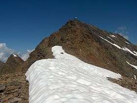
The Roteck (Italian: Monte Rosso) is the highest peak in the Texel group of the Ötztal Alps.
See also
This article is issued from
Wikipedia.
The text is licensed under Creative Commons - Attribution - Sharealike.
Additional terms may apply for the media files.