Roseville, Barren County, Kentucky
| Roseville, Kentucky | |
|---|---|
| Unincorporated community | |
 Roseville, Kentucky | |
| Coordinates: 36°53′14″N 85°55′32″W / 36.88722°N 85.92556°WCoordinates: 36°53′14″N 85°55′32″W / 36.88722°N 85.92556°W | |
| Country | United States |
| State | Kentucky |
| County | Barren |
| Elevation | 741 ft (226 m) |
| Time zone | UTC-6 (Central (CST)) |
| • Summer (DST) | UTC-5 (CDT) |
| Area code(s) | 270 |
| GNIS feature ID | 502353[1] |
Roseville is an unincorporated community in Barren County, Kentucky, United States. Roseville is located at the junction of Kentucky Route 249 and Kentucky Route 1318 7.5 miles (12.1 km) south of Glasgow.[2] Landrum, which is listed on the National Register of Historic Places, is located in Roseville.[3]
References
- ↑ "Roseville". Geographic Names Information System. United States Geological Survey.
- ↑ State Primary Road System: Barren County (PDF) (Map). Kentucky Transportation Cabinet. 2012. Retrieved January 4, 2013.
- ↑ National Park Service (2010-07-09). "National Register Information System". National Register of Historic Places. National Park Service.
Municipalities and communities of Barren County, Kentucky, United States | ||
|---|---|---|
| Cities | 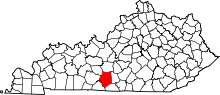 | |
| CDP | ||
| Unincorporated communities |
| |
This article is issued from
Wikipedia.
The text is licensed under Creative Commons - Attribution - Sharealike.
Additional terms may apply for the media files.