Rosendale, Minnesota
| Rosendale, Minnesota | |
|---|---|
| Unincorporated community | |
 Rosendale, Minnesota Location of the community of Rosendale within Danielson Township, Meeker County  Rosendale, Minnesota Rosendale, Minnesota (the US) | |
| Coordinates: 45°02′26″N 94°42′24″W / 45.04056°N 94.70667°WCoordinates: 45°02′26″N 94°42′24″W / 45.04056°N 94.70667°W | |
| Country | United States |
| State | Minnesota |
| County | Meeker |
| Township | Danielson Township |
| Elevation | 1,181 ft (360 m) |
| Time zone | UTC-6 (Central (CST)) |
| • Summer (DST) | UTC-5 (CDT) |
| ZIP code | 56243 |
| Area code(s) | 320 |
| GNIS feature ID | 650294[1] |
Rosendale is an unincorporated community in Danielson Township, Meeker County, Minnesota, United States.
The community is located along Meeker County Road 28 near its junction with State Highway 4 (MN 4).
Nearby places include Grove City, Cosmos, Atwater, and Litchfield. Rosendale is 14 miles southwest of Litchfield.
References
Municipalities and communities of Meeker County, Minnesota, United States | ||
|---|---|---|
| Cities | 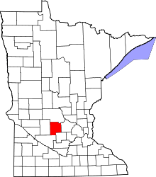 | |
| Townships | ||
| Unincorporated communities | ||
| Footnotes | ‡This populated place also has portions in an adjacent county or counties | |
This article is issued from
Wikipedia.
The text is licensed under Creative Commons - Attribution - Sharealike.
Additional terms may apply for the media files.