Romainville Island, Seychelles
| Nickname: Ile de Romainville | |
|---|---|
 Romainville Island | |
| Geography | |
| Location | Seychelles, Indian Ocean |
| Coordinates | 4°37′S 55°28′E / 4.617°S 55.467°ECoordinates: 4°37′S 55°28′E / 4.617°S 55.467°E |
| Archipelago | Inner Islands, Seychelles |
| Adjacent bodies of water | Indian Ocean |
| Total islands | 1 |
| Major islands |
|
| Area | 0.194 km2 (0.075 sq mi) |
| Length | 1.0 km (0.62 mi) |
| Width | 0.3 km (0.19 mi) |
| Coastline | 2.4 km (1.49 mi) |
| Highest elevation | 0 m (0 ft) |
| Administration | |
| Group | Granitic Seychelles |
| Sub-Group | Mahe Islands |
| Sub-Group | Mahe Port Islands |
| Districts | English River |
| Largest settlement | Romainville (pop. 2) |
| Demographics | |
| Population | 2 (2014) |
| Pop. density | 10.3 /km2 (26.7 /sq mi) |
| Ethnic groups | Creole, French, East Africans, Indians. |
| Additional information | |
| Time zone | |
| ISO code | SC-16 |
| Official website |
www |
Romainville Island is an artificial island in Seychelles, lying 2 km from the capital Victoria.
History
The island was created artificially during the 2000s. It belongs to the Mahe Port Islands, which are mostly artificial islands created by funds from Dubai when the Dubai dredger was placed in Seychelles. The works began in 1998.[1][2] In 2012 the island was ready for installment of wind turbines.[3][4] In 2013 the island was visited by UN inspectors inspecting worldwide scale of wind farms.[5] In the end of 2013 the wind farm was launched[6] in 2014, it was reported that the PUC farm on Romainville was a success[7][8][9] in 2018, Masdar will open a solar farm on the island [10]
Geography
The artificial island plan is an industrialized plan [11]
Demographics
The warden's house is located on the island's south point.
Administration
The island belongs to English River District.[12]
Image gallery
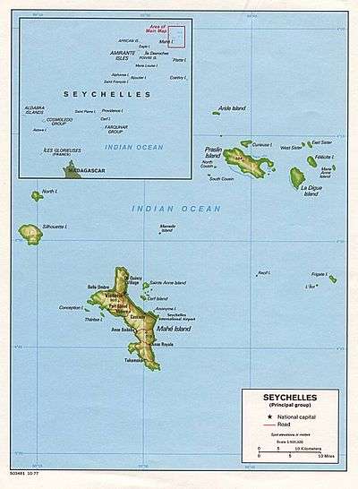 Map 1
Map 1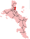 District Map
References
- ↑ phase 2 completed for all islands in news Archived 2016-04-17 at the Wayback Machine.
- ↑ phase 2 completed for all islands in news
- ↑ News
- ↑ News
- ↑ News
- ↑ Masdar Launch in news
- ↑ Report on Romainville
- ↑ Quick facts from Masdar
- ↑ Info from Masdar
- ↑ Solar panel farm in news
- ↑ Island development info
- ↑ District map
External links
| Wikimedia Commons has media related to Romainville Island. |