Rohini, Delhi
| Rohini | |
|---|---|
| Neighbourhood | |
 Rohini Location in north-west Delhi, India  Rohini Rohini (India) | |
| Coordinates: 28°43′58″N 77°07′27″E / 28.732865°N 77.124180°ECoordinates: 28°43′58″N 77°07′27″E / 28.732865°N 77.124180°E | |
| Country |
|
| State | Delhi |
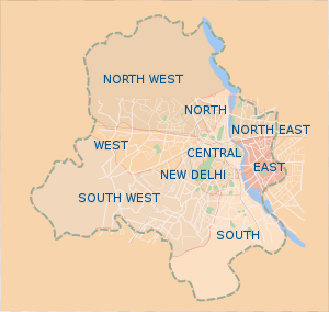
| District | North West Delhi |
| Government | |
| • Body | North Delhi Municipal Corporation |
| • Member of Parliament | Udit Raj |
| Area | |
| • Total | 60.880 km2 (23.506 sq mi) |
| Elevation | 216.2 m (709.3 ft) |
| Languages | |
| • Official | Hindi, English |
| Time zone | UTC+5:30 (IST) |
| PIN | 110085 |
| Lok Sabha constituency | North-West Delhi |
| Civic agency | North Delhi Municipal Corporation |
Rohini is a well developed residential city in North West Delhi in India. It was the first sub-city project of Delhi Development Authority (DDA), which was started in the 1980s to provide a composite society for all income groups.[1] Rohini is one of the 12 zones administered under the Municipal Corporation of Delhi.[2]
Vijender Gupta is the Member of Legislative Assembly for Rohini Vidhan Sabha Constituency. The location has composite demographics with its inhabitants following different faiths and religions and speaking an array of languages including viHindi and Punjabi.
The neighbouring areas are Badli, Pitampura, Shalimar Bagh, Haider Pur, Mangol Puri, Paschim Vihar, Narela Sub City, Budh Vihar, Mukarba Chowk, Shahbaad Daulatpur (Delhi Technological University) and Bawana.
Rohini Heliport owned by Pawan Hans, was inaugurated by Union Civil Aviation Minister, Ashok Gajapathi Raju on 28 February 2017.[3] The heliport, spread over 25 acres and situated a few kilometres away from the Rithala metro station, is the first of its kind in the country.[4]
Rohini
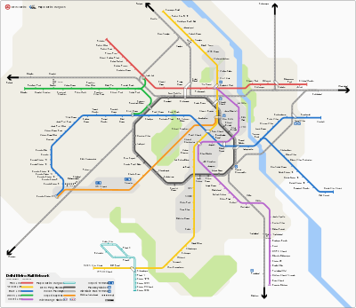
Rohini has three stations on the Red Line of Delhi Metro Line 1, which connects from Dilshad Garden, Kashmere Gate to Rohini East, Rohini West and Rithala Stations, making it one of Delhi Metro's major hubs.
Rohini also has one station on the Yellow Line of Delhi Metro, which connects from Samaypur Badli to Huda City Centre Gurgaon making it very well connected to all major places like Connaught Place, Saket and Cyber Hub. Rohini Sector 18 & 19 is also a metro station on yellow line.
Population and area
Rohini has a population of approximately 860,000 inhabitants and covers an area of 3,015 hectares.
The sub-city is under active development, and is expected to expand to 7,548 hectares and 1.1 million people by the completion of the development project.
References
- ↑ "Urban Extension Projects - Rohini". Delhi Development Authority. Retrieved 16 May 2018.
- ↑ Zones Archived 2009-01-09 at the Wayback Machine. Municipal Corporation of Delhi.
- ↑ "India's first heliport to open in Delhi next week". The Indian Express. 21 February 2017. Retrieved 21 February 2017.
- ↑ "Pawan Hans Conducts Successful Flight Test at Rohini Heliport". The New Indian Express. 18 February 2016. Retrieved 22 February 2016.