Rogersville, Pennsylvania
| Rogersville, Pennsylvania | |
|---|---|
| Census-designated place | |
 Rogersville  Rogersville | |
| Coordinates: 39°52′50″N 80°16′10″W / 39.88056°N 80.26944°WCoordinates: 39°52′50″N 80°16′10″W / 39.88056°N 80.26944°W | |
| Country | United States |
| State | Pennsylvania |
| County | Greene |
| Township | Center |
| Area | |
| • Total | 0.41 sq mi (1.06 km2) |
| • Land | 0.41 sq mi (1.06 km2) |
| • Water | 0.0 sq mi (0.0 km2) |
| Elevation | 1,056 ft (322 m) |
| Population (2010) | |
| • Total | 249 |
| • Density | 610/sq mi (235.4/km2) |
| Time zone | UTC-5 (Eastern (EST)) |
| • Summer (DST) | UTC-4 (EDT) |
| ZIP code | 15359 |
| FIPS code | 42-65848 |
| GNIS feature ID | 2630036 |
Rogersville is an unincorporated community and census-designated place (CDP) in Center Township, Greene County, Pennsylvania, United States. It is located 6 miles (10 km) west of the borough of Waynesburg (the Greene County seat) along Pennsylvania Route 18. As of the 2010 census the population was 249.[1]
References
- ↑ "Geographic Identifiers: 2010 Demographic Profile Data (G001): Rogersville CDP, Pennsylvania". American Factfinder. U.S. Census Bureau. Retrieved February 8, 2017.
External links
Municipalities and communities of Greene County, Pennsylvania, United States | ||
|---|---|---|
| Boroughs | 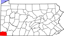 | |
| Townships | ||
| CDPs | ||
| Unincorporated communities | ||
This article is issued from
Wikipedia.
The text is licensed under Creative Commons - Attribution - Sharealike.
Additional terms may apply for the media files.