Dry Tavern, Pennsylvania
| Dry Tavern, Pennsylvania | |
|---|---|
| Census-designated place | |
 Dry Tavern  Dry Tavern | |
| Coordinates: 39°56′24″N 80°00′34″W / 39.94000°N 80.00944°WCoordinates: 39°56′24″N 80°00′34″W / 39.94000°N 80.00944°W | |
| Country | United States |
| State | Pennsylvania |
| County | Greene |
| Township | Jefferson |
| Area | |
| • Total | 1.35 sq mi (3.50 km2) |
| • Land | 1.35 sq mi (3.50 km2) |
| • Water | 0.0 sq mi (0.0 km2) |
| Elevation | 1,033 ft (315 m) |
| Population (2010) | |
| • Total | 697 |
| • Density | 516/sq mi (199.1/km2) |
| Time zone | UTC-5 (Eastern (EST)) |
| • Summer (DST) | UTC-4 (EDT) |
| FIPS code | 42-20080 |
| GNIS feature ID | 2634213 |
Dry Tavern is a census-designated place in Jefferson Township, Greene County, Pennsylvania, in the United States. It is located next to the borough of Rices Landing along Pennsylvania Route 88, on high ground south of the Monongahela River. As of the 2010 census the population was 697.[1]
Dry Tavern was named from a local tavern which sold no alcohol.[2]
References
- ↑ "Geographic Identifiers: 2010 Demographic Profile Data (G001): Dry Tavern CDP, Pennsylvania". American Factfinder. U.S. Census Bureau. Retrieved February 7, 2017.
- ↑ Haney, Christine V. (September 4, 1988). "Unusual town names give Greene Co. color". Observer-Reporter. pp. B1. Retrieved 3 May 2015.
External links
Municipalities and communities of Greene County, Pennsylvania, United States | ||
|---|---|---|
| Boroughs | 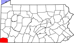 | |
| Townships | ||
| CDPs | ||
| Unincorporated communities | ||
This article is issued from
Wikipedia.
The text is licensed under Creative Commons - Attribution - Sharealike.
Additional terms may apply for the media files.