Rodeo Municipality
| Rodeo | |
|---|---|
| Municipality | |
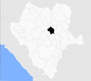 Municipality of Rodeo in Durango | |
|
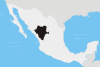
Rodeo Location in Mexico | |
| Coordinates: 25°11′N 104°34′W / 25.183°N 104.567°WCoordinates: 25°11′N 104°34′W / 25.183°N 104.567°W | |
| Country |
|
| State | Durango |
| Municipal seat | Rodeo |
| Area | |
| • Total | 1,854.9 km2 (716.2 sq mi) |
| Population (2010) | |
| • Total | 12,788 |
| • Density | 6.9/km2 (18/sq mi) |
Rodeo is one of the 39 municipalities of Durango, in north-western Mexico. The municipal seat lies at Rodeo. The municipality covers an area of 1,854.9 km².
As of 2010, the municipality had a total population of 12,788,[1] up from 11,231 as of 2005.[2]
As of 2010, the town of Rodeo had a population of 4,666.[1] Other than the town of Rodeo, the municipality had 71 localities, the largest of which (with 2010 population in parentheses) was: Abasolo (1,208), classified as rural.[1]
References
- 1 2 3 "Rodeo". Catálogo de Localidades. Secretaría de Desarrollo Social (SEDESOL). Retrieved 23 April 2014.
- ↑ "Rodeo". Enciclopedia de los Municipios de México. Instituto Nacional para el Federalismo y el Desarrollo Municipal. Archived from the original on February 23, 2007. Retrieved November 18, 2008.
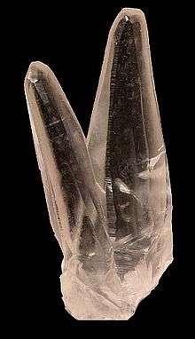
Twinned calcite crystals from Rodeo Municipio
This article is issued from
Wikipedia.
The text is licensed under Creative Commons - Attribution - Sharealike.
Additional terms may apply for the media files.