Rockville Township, Bates County, Missouri
| Rockville Township | |
|---|---|
| Township | |
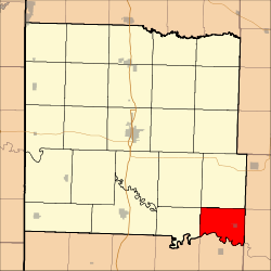 Location in Bates County | |
| Coordinates: 38°04′22″N 94°05′16″W / 38.07278°N 94.08778°WCoordinates: 38°04′22″N 94°05′16″W / 38.07278°N 94.08778°W | |
| Country |
|
| State |
|
| County | Bates |
| Area | |
| • Total | 25.17 sq mi (65.19 km2) |
| • Land | 24.67 sq mi (63.89 km2) |
| • Water | 0.5 sq mi (1.3 km2) 1.99% |
| Elevation | 751 ft (229 m) |
| Population (2000) | |
| • Total | 271 |
| • Density | 11/sq mi (4.2/km2) |
| Time zone | UTC-6 (CST) |
| • Summer (DST) | UTC-5 (CDT) |
| ZIP codes | 64724, 64780 |
| GNIS feature ID | 0766306 |
Rockville Township is one of twenty-four townships in Bates County, Missouri, USA. As of the 2000 census, its population was 271.[1]
Rockville Township was established in 1872, taking its name from Rockville, Missouri.[2]
Geography
According to the United States Census Bureau, Rockville Township covers an area of 25.17 square miles (65.19 square kilometers); of this, 24.67 square miles (63.89 square kilometers, 98.01 percent) is land and 0.5 square miles (1.3 square kilometers, 1.99 percent) is water.
Cities, towns, villages
Adjacent townships
- Hudson Township (north)
- Appleton Township, St. Clair County (northeast)
- Taber Township, St. Clair County (east)
- Speedwell Township, St. Clair County (southeast)
- Bacon Township, Vernon County (south)
- Blue Mound Township, Vernon County (southwest)
- Prairie Township (west)
- Pleasant Gap Township (northwest)
Cemeteries
The township contains Rockville Cemetery.
Airports and landing strips
- Heiman Field
Lakes
- Horseshoe Lake
- Jones Lake
School districts
- Appleton City R-II
- Rich Hill R-IV
Political districts
- Missouri's 4th congressional district
- State House District 120
- State Senate District 31
References
- United States Census Bureau 2008 TIGER/Line Shapefiles
- United States Board on Geographic Names (GNIS)
- United States National Atlas
- ↑ United States Census Bureau American FactFinder
- ↑ "Bates County Place Names, 1928-1945 (archived)". The State Historical Society of Missouri. Archived from the original on 24 June 2016. Retrieved 1 September 2016.
External links
Places adjacent to Rockville Township, Bates County, Missouri | |
|---|---|
Municipalities and communities of Bates County, Missouri, United States | ||
|---|---|---|
| Cities | 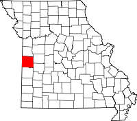 | |
| Villages | ||
| Townships | ||
| Unincorporated communities | ||
| Ghost towns | ||
| Footnotes | ‡This populated place also has portions in an adjacent county or counties | |
This article is issued from
Wikipedia.
The text is licensed under Creative Commons - Attribution - Sharealike.
Additional terms may apply for the media files.