Rockford Township, Floyd County, Iowa
| Rockford Township | |
|---|---|
| Township | |
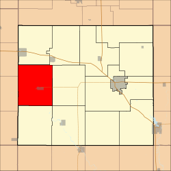 Location in Floyd County | |
| Coordinates: 43°03′35″N 92°57′56″W / 43.05972°N 92.96556°WCoordinates: 43°03′35″N 92°57′56″W / 43.05972°N 92.96556°W | |
| Country |
|
| State |
|
| County | Floyd |
| Area | |
| • Total | 42.43 sq mi (109.89 km2) |
| • Land | 42.43 sq mi (109.89 km2) |
| • Water | 0 sq mi (0 km2) 0% |
| Elevation | 1,024 ft (312 m) |
| Population (2000) | |
| • Total | 1,331 |
| • Density | 31.4/sq mi (12.1/km2) |
| Time zone | UTC-6 (CST) |
| • Summer (DST) | UTC-5 (CDT) |
| ZIP codes | 50458, 50468, 50471 |
| GNIS feature ID | 0468633 |
Rockford Township is one of twelve townships in Floyd County, Iowa, USA. As of the 2000 census, its population was 1,331.[1]
Geography
According to the United States Census Bureau, Rockford Township covers an area of 42.43 square miles (109.89 square kilometers).
Cities, towns, villages
Adjacent townships
- Rock Grove Township (north)
- Rudd Township (northeast)
- Ulster Township (east)
- Union Township (southeast)
- Scott Township (south)
- Owen Township, Cerro Gordo County (west)
- Portland Township, Cerro Gordo County (northwest)
Cemeteries
The township contains Riverside Cemetery.
Major highways
School districts
- Nora Springs-Rock Falls Community School District
- Rudd-Rockford-Marble Rock Community School District
Political districts
- Iowa's 4th congressional district
- State House District 14
- State Senate District 7
References
External links
Places adjacent to Rockford Township, Floyd County, Iowa | |
|---|---|
Municipalities and communities of Floyd County, Iowa, United States | ||
|---|---|---|
| Cities | ||
| Townships | ||
| CDP | ||
| Other unincorporated communities | ||
| Footnotes | ‡This populated place also has portions in an adjacent county or counties | |
This article is issued from
Wikipedia.
The text is licensed under Creative Commons - Attribution - Sharealike.
Additional terms may apply for the media files.