River Ray, Wiltshire
| River Ray, Wiltshire | |
| River | |
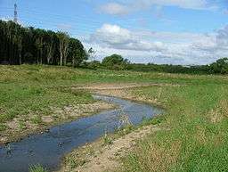 River Ray at Rivermead, Swindon | |
| Country | England |
|---|---|
| Counties | Wiltshire |
| Towns | Swindon |
| Source | |
| - location | Wroughton, Wiltshire |
| - coordinates | 51°31′24″N 1°47′29″W / 51.52333°N 1.79139°W |
| Mouth | River Thames |
| - location | Calcutt, Wiltshire |
| - coordinates | 51°38′39″N 1°49′20″W / 51.64417°N 1.82222°WCoordinates: 51°38′39″N 1°49′20″W / 51.64417°N 1.82222°W |
| Length | 21.8 km (14 mi) |
| Discharge | for Water Eaton, Wiltshire |
| - average | 1.28 m3/s (45 cu ft/s) |
| - max | 32.2 m3/s (1,137 cu ft/s) 27 September 1974 |
| - min | 0.26 m3/s (9 cu ft/s) 28 August 1976 |
The River Ray is a tributary of the River Thames in England which flows through Wiltshire.
The river rises at Wroughton to the south of Swindon and runs in a generally northern direction, passing to the west of the town via Shaw.[1] Near Roughmoor it is joined from the west by the Lydiard Brook. The river joins the Thames on the southern bank near Calcutt, west of Cricklade, just upstream of Water Eaton House Bridge. Its length is about 11.5 km (7.1 mi) from its source to the Lydiard Brook,[2] and 10.3 km (6.4 mi) from there to the Thames.[3]
The river has been subject to a restoration project run by the Wiltshire Wildlife Trust. The final stage, completed in December 2007, was to build a tunnel near the Great Western Way at Rivermead to allow the nine species of fish to travel the length of the river without obstruction.[4]
See also
References
- ↑ Fred. S Thacker The Thames Highway Vol II Locks and Weirs 1920
- ↑ "Catchment Data Explorer: Ray (Wiltshire): source to Lydiard Brook". Environment Agency. Retrieved 29 December 2017.
- ↑ "Catchment Data Explorer: Ray (Wiltshire): Lydiard Brook to Thames". Environment Agency. Retrieved 29 December 2017.
- ↑ BBC News 16 December 2007 Tunnel allows fish to swim freely
| Next confluence upstream | River Thames | Next confluence downstream |
| River Key (south) | River Ray, Wiltshire | River Coln (north) with Thames and Severn Canal |