River Ara
| River Ara | |
|---|---|
 | |
| Native name | An Ára |
| Country | Ireland |
| Physical characteristics | |
| Main source |
Shrough, County Tipperary 136 m (446 ft) |
| River mouth | Celtic Sea at Waterford Harbour via Aherlow River and Suir |
| Length | 29.4 km (18.3 mi) |
| Discharge |
|
The River Ara (/ˈærə/; Irish: An Ára) is a river in County Tipperary, Ireland.
Name
The Ara (sometimes spelled Arra) takes its name from the ancient territory of Ara (Aradh, Tir Arad, Dál Cairbri Arad) in which it is found, ruled by the Ó Donnagáin (O'Donegans). It gives its name to the barony of Owney and Arra and the Arra Mountains, while Tipperary town (and thus County Tipperary) takes its name from Tiobrad Árann (many spelling variants exist), "the spring by the Ara."[1][2]
Course
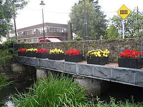
The Ara rises in Shrough in the Glen of Aherlow. It flows north, passing under the R662 near Mount Bruis village and meeting a tributary in Shronell. It flows on eastwards, passing through Tipperary where it passes under the Limerick–Rosslare railway line, is bridged by the R664 and separates The Abbey School from the rest of the town. The Ara flows southward past Tipperary Golf Club and then eastward through Bansha Wood.[3] It is bridged by the N24 near Kilshane House and recrosses the Limerick–Rosslare railway line. It continues southeastwards through Bansha and is crosses by Bansha Bridge, a triple-arched limestone bridge (1863).[4] In Ballymorris it drains into the Aherlow River.
Wildlife
As with many tributaries of the River Suir, the Ara is a noted brown trout fishery.[5][6] A restaurant on Abbey Street, Tipperary, just yards from the river, bears the name "The Brown Trout".[7]
See also
References
- ↑ "Tiobraid Árann/Tipperary". logainm.ie.
- ↑ An Ára/River Ara | logainm.ie
- ↑ Bansha Wood | Activities | Walking | Park and Forest Walks | All Ireland | Republic of Ireland | Tipperary | Bansha | Discover Ireland
- ↑ "Bansha Bridge, Bansha, Tipperary South: Buildings of Ireland: National Inventory of Architectural Heritage". buildingsofireland.ie.
- ↑ Infowing - catch the best fishing in Ireland :: Waterway
- ↑ River Suir Tipperary Ireland Archived 2013-12-07 at the Wayback Machine.
- ↑ • Brown Trout Restaurant The • Tipperary •
Places in County Tipperary | ||
|---|---|---|
| Towns | 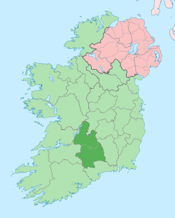 | |
| Villages |
| |
| Baronies | ||
| ||
Coordinates: 52°25′37″N 8°14′20″W / 52.427047°N 8.238797°W