Ripponlea railway station
Ripponlea | |||||||||||
|---|---|---|---|---|---|---|---|---|---|---|---|
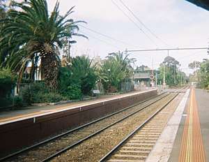 Ripponlea station 2017 | |||||||||||
| Location | Glen Eira Road, Balaclava | ||||||||||
| Coordinates | 37°52′33″S 144°59′42″E / 37.8759°S 144.9951°ECoordinates: 37°52′33″S 144°59′42″E / 37.8759°S 144.9951°E | ||||||||||
| Owned by | VicTrack | ||||||||||
| Operated by | Metro | ||||||||||
| Line(s) | Sandringham | ||||||||||
| Distance | 9.83 kilometres from Southern Cross | ||||||||||
| Platforms | 2 side | ||||||||||
| Tracks | 2 | ||||||||||
| Connections | Bus | ||||||||||
| Construction | |||||||||||
| Structure type | Ground | ||||||||||
| Other information | |||||||||||
| Status | Host station | ||||||||||
| Station code | RIP | ||||||||||
| Fare zone | Myki zone 1 | ||||||||||
| Website | Public Transport Victoria | ||||||||||
| History | |||||||||||
| Opened | 1 May 1912 | ||||||||||
| Electrified | Yes | ||||||||||
| Services | |||||||||||
| |||||||||||
Ripponlea railway station is located on the Sandringham line in Victoria, Australia. It serves the south-eastern Melbourne suburb of Ripponlea opening on 1 May 1912.[1]
It is located at the northern end of the Glen Eira Road level crossing, with station access from Glen Eira Road, Oak Grove and Morres Street. Platform 1 has a large weatherboard building, Platform 2 a smaller weatherboard building.
Platforms & services
Ripponlea has two side platforms. It is serviced by Metro Trains Sandringham line services travelling between Flinders Street and Sandringham.[2]
Platform 1:
- Sandringham line: all stations services to Flinders Street
Platform 2:
- Sandringham line: all stations services to Sandringham
Transport links
CDC Melbourne operates one route via Ripponlea station:
- 623: St Kilda to Glen Waverley[3]
Yarra Trams operates one route via St Kilda Road Melbourne tram route
67 Carnegie to Melbourne University
References
- ↑ Ripponlea Vicsig
- ↑ Sandringham Line timetable Public Transport Victoria
- ↑ Route 623 Glen Waverley - St Kilda timetable Archived 29 April 2014 at the Wayback Machine. Public Transport Victoria
External links
- Melway map at street-directory.com.au
This article is issued from
Wikipedia.
The text is licensed under Creative Commons - Attribution - Sharealike.
Additional terms may apply for the media files.