Riosucio, Chocó
| Riosucio | |||
|---|---|---|---|
| Municipality and town | |||
| |||
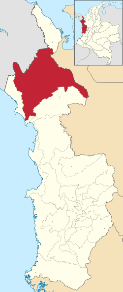 Location of the municipality and town of Riosucio in the Chocó Department of Colombia. | |||
| Coordinates: 7.4406°0′0″N 77.1189°0′0″W / 7.44060°N 77.11890°W | |||
| Country |
| ||
| Department | Chocó Department | ||
| Founded | 1518 | ||
| Area | |||
| • Municipality and town | 5,818.5 km2 (2,246.5 sq mi) | ||
| Elevation | 8 m (26.3 ft) | ||
| Population (2015) | |||
| • Municipality and town | 28,832 | ||
| • Density | 4.95/km2 (12.83/sq mi) | ||
| • Metro | 8,458 | ||
| Time zone | UTC-5 (Colombia Standard Time) | ||
.svg.png)

Riosucio (Spanish pronunciation: [rjoˈsusjo]) is a municipality and town in the Department of Chocó, Colombia. It is located in the region of Urabá, on the Atrato River basin. It borders Panama and the municipality of Unguía at its north, Turbo, Mutatá (both in Antioquia), Juradó and Panama at the east, and Carmen del Darien and Solano Bay at its south. The town is inaccessible by roads and there is no airport, the river is the main system of transportation and access. [1]
History
The region of Urabá and Darien began in 1501 with the first Spaniard explorations of Rodrigo de Bastidas, Vasco Núñez de Balboa and Juan de la Cosa. The indigenous communities were made by peoples of the Emberá and Katio nations. The Hispanic invaders tried to control the area, but the indigenous defenses kept them away until the 18th century when trade became active and the zone became again of colonial interests.
The name "Riosucio" (in English "Dirty River") is due to the river of that same name that joins the Atrato River. The town was founded by the Spaniard Domingo Bailon.
In 1996, the town was the target of a violent operation of the Colombian military along with paramilitary groups, in response to organizing by Afro-Colombians and the subsequent law granting land rights to residents of Riosucio and other nearby towns.[2] Hundreds were killed, many disappeared and over 22,000 survivors were forced to leave their lands and move to poor neighborhoods of big cities around the country.
Geography
The municipality is rather forest located at the northern part of the Chocó State in a region called "Down Chocoan Atrato-Urabá" (Bajo Atrato-Urabá Chocoano). The territory is crossed by the Atrato, one of the main Colombian rivers and it is joined by other streams like Rio Sucio, Salaquí and Truandó rivers. There is not an airport and it has a road that goes to Chigorodó - Antioquia and Belén de Bajirá - Mutatá, but the forest road is undeveloped. To travel to the State capital, Quibdó at its south, people use the river and the same to reach the Gulf of Urabá and therefore the Turbo Port.
Economy
Located in a forest region of Darien, Riosucio is dedicated to wood exploitation, agriculture and cattle. The African Palm is one of the main products.
There are places of interest for tourism, but this industry is not well developed due to lack of infrastructure and general security. The main places:
- Los Katíos National Park, a territory that is shared with Panamá and that was declared a World Heritage Site in 1994 by UNESCO. The area protects not only a rich and fascinating natural environment with unique animal and plant species, but also the ancestral culture of Katíos and other aboriginal peoples of the area.
- The Gulf of Urabá and the mouth of the Atrato River. The place has natural beaches and river and sea islands.
- The historical site of Santa María la Antigua del Darién, the first European settlement built in the Americas mainland in 1510 by Alonso de Ojeda and destroyed in 1517 by the indios and therefore abandoned.
- The rural life of the Afro-American and Indo-American communities of the region around the river and the sea with all their ancestral traditions and natural environment.
Culture
The region is settled mainly by Afro-Colombian communities and the aborigine peoples of Katíos, Emberás and other ancestral groups. Their food, feasts, religiosity and traditions are influenced by their identity. The Spanish language is the lingua franca, but there are several dialects and languages, especially to the aboriginal groups. The Afro-Colombians keep many African expressions, but they have borrow ancestral American terms from the aborigines. The culture belongs to the river and music and dances are influenced by their African and Aboriginal cultural elements.
The main feats in the municipalities are the Sweet Festival during the Holy Week, the Saint Isidore the Laborer Feast in May and the Carnival of Our Lady of Mount Carmel (6th to July 16).
References
- ↑ The Silent Scream, http://venturafilms.com
- ↑ The Silent Scream, http://venturafilms.com