Rimouski Airport
| Rimouski Airport | |||||||||||
|---|---|---|---|---|---|---|---|---|---|---|---|
 | |||||||||||
| Summary | |||||||||||
| Airport type | Public | ||||||||||
| Operator | Municipality of Rimouski | ||||||||||
| Location | Rimouski, Quebec | ||||||||||
| Time zone | EST (UTC−05:00) | ||||||||||
| • Summer (DST) | EDT (UTC−04:00) | ||||||||||
| Elevation AMSL | 82 ft / 25 m | ||||||||||
| Coordinates | 48°28′40″N 068°29′47″W / 48.47778°N 68.49639°WCoordinates: 48°28′40″N 068°29′47″W / 48.47778°N 68.49639°W | ||||||||||
| Map | |||||||||||
 CYXK Location in Quebec | |||||||||||
| Runways | |||||||||||
| |||||||||||
| Statistics (2010) | |||||||||||
| |||||||||||
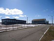
Rimouski Airport, (IATA: YXK, ICAO: CYXK), is an airport located 1.8 nautical miles (3.3 km; 2.1 mi) northeast of Rimouski, Quebec, Canada. It only handles general aviation and cargo flights.
Accidents and incidents
- On 29 May 1973, Douglas C-47A CF-QBB of Air Gaspé crashed on approach, killing all four people on board.[3]
References
| Wikimedia Commons has media related to Rimouski airport. |
- ↑ Canada Flight Supplement. Effective 0901Z 19 July 2018 to 0901Z 13 September 2018.
- ↑ Total aircraft movements by class of operation
- ↑ "CF-QBB Accident description". Aviation Safety Network. Retrieved 26 August 2010.
| By name | |
|---|---|
| By location indicator | |
| By province/territory | |
| By area | |
| National Airports System | |
| Related | |
| |
This article is issued from
Wikipedia.
The text is licensed under Creative Commons - Attribution - Sharealike.
Additional terms may apply for the media files.