Riley Lake (Muskoka)
| Riley Lake | |
| Lake | |
| Country | Canada |
|---|---|
| Province | Ontario |
| Region | Central Ontario |
| District | Muskoka |
| Municipality | Gravenhurst |
| Part of | Great Lakes Basin |
| Settlements | Riley Lake |
| Elevation | 247 m (810 ft) |
| Coordinates | 44°50′13″N 79°10′54″W / 44.83694°N 79.18167°W[1]Coordinates: 44°50′13″N 79°10′54″W / 44.83694°N 79.18167°W[1] |
| Primary outflow | Riley Creek |
| - coordinates | 44°49′29″N 79°10′36″W / 44.82472°N 79.17667°W |
| Length | 3.9 km (2 mi) |
| Width | 2.7 km (2 mi) |
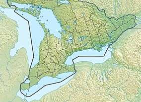 Location of Riley Lake in southern Ontario | |
Riley Lake is a lake in geographic Ryde Township[2] in the town of Gravenhurst, District Municipality of Muskoka in Central Ontario, Canada.[1] It is part of the Great Lakes Basin.
There is one named inflow, Green's Creek, at the northeast. The primary outflow is Riley Creek at the south that flows via the Black River and Severn River to Georgian Bay on Lake Huron.
The community of Riley Lake is located on the lake.[3]
See also
References
- 1 2 3 "Riley Lake". Geographical Names Data Base. Natural Resources Canada. Retrieved 2012-09-07. (lake)
- ↑ "Ryde" (PDF). Geology Ontario - Historic Claim Maps. Ontario Ministry of Northern Development, Mines and Forestry. Retrieved 2018-02-07.
- ↑ "Riley Lake". Geographical Names Data Base. Natural Resources Canada. Retrieved 2012-09-07. (settlement)
Other map sources:
- Map 5 (PDF) (Map). 1 : 700,000. Official road map of Ontario. Ministry of Transportation of Ontario. 2010-01-01. Retrieved 2012-09-07.
- Restructured municipalities - Ontario map #4 (Map). Restructuring Maps of Ontario. Ontario Ministry of Municipal Affairs and Housing. 2006. Retrieved 2012-09-07.
This article is issued from
Wikipedia.
The text is licensed under Creative Commons - Attribution - Sharealike.
Additional terms may apply for the media files.