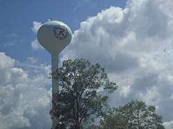
Richland, Mississippi
| Richland, Mississippi | |
|---|---|
| City | |
| City of Richland | |
 | |
| Motto(s): "Proud to Call it Home!", "An Excellent Choice" | |
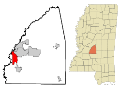 Location in Rankin County and the state of Mississippi | |
 Richland Location of Richland in the US | |
| Coordinates: 32°13′47″N 90°9′35″W / 32.22972°N 90.15972°WCoordinates: 32°13′47″N 90°9′35″W / 32.22972°N 90.15972°W | |
| Country |
|
| State |
|
| County | Rankin |
| District | 1 |
| Incorporated[1] | October 31, 1974 |
| Government[2] | |
| • Type | Mayor–Council |
| • Mayor | Mark Scarborough (I) |
| • Board of Aldermen | Richland Board of Aldermen |
| Area | |
| • Total | 12.2 sq mi (31.7 km2) |
| • Land | 12.2 sq mi (31.7 km2) |
| • Water | 0.0 sq mi (0.0 km2) |
| Elevation | 266 ft (81 m) |
| Population (2010) | |
| • Total | 6,912 |
| • Estimate (2016)[3] | 7,111 |
| • Density | 570/sq mi (220/km2) |
| Time zone | UTC-6 (Central (CST)) |
| • Summer (DST) | UTC-5 (CDT) |
| ZIP code(s) | 39073, 39208, 39218, 39232 |
| Area code(s) | 601 |
| FIPS code | 28-62400 |
| GNIS feature ID | 690674 |
| Major airport | JAN |
| Website |
richlandms |
Richland is a city in Rankin County, Mississippi. The population was 6,027 at the 2000 census. It is part of the Jackson Metropolitan Statistical Area.
Geography
Richland is located at 32°13′47″N 90°9′35″W / 32.22972°N 90.15972°W (32.229844, -90.159724).[4] According to the United States Census Bureau, the city has a total area of 12.2 square miles (32 km2), of which 12.2 square miles (32 km2) is land and 0.04-square-mile (0.10 km2) (0.16%) is water.
Demographics
| Historical population | |||
|---|---|---|---|
| Census | Pop. | %± | |
| 1980 | 3,955 | — | |
| 1990 | 4,014 | 1.5% | |
| 2000 | 6,027 | 50.1% | |
| 2010 | 6,912 | 14.7% | |
| Est. 2016 | 7,111 | [3] | 2.9% |
| U.S. Decennial Census[5] | |||
As of the census[6] of 2000, there were 6,027 people, 2,303 households, and 1,688 families residing in the city. The population density was 492.7 people per square mile (190.3/km²). There were 2,540 housing units at an average density of 207.6 per square mile (80.2/km²). The racial makeup of the city was 91.97% White, 5.28% African American, 0.08% Native American, 1.51% Asian, 0.02% Pacific Islander, 0.20% from other races, and 0.95% from two or more races. Hispanic or Latino of any race were 0.88% of the population.
There were 2,303 households out of which 37.5% had children under the age of 18 living with them, 54.8% were married couples living together, 13.4% had a female householder with no husband present, and 26.7% were non-families. 21.8% of all households were made up of individuals and 6.8% had someone living alone who was 65 years of age or older. The average household size was 2.62 and the average family size was 3.05.
In the city, the population was spread out with 27.3% under the age of 18, 9.8% from 18 to 24, 33.6% from 25 to 44, 20.1% from 45 to 64, and 9.3% who were 65 years of age or older. The median age was 32 years. For every 100 females, there were 98.2 males. For every 100 females age 18 and over, there were 94.0 males.
The median income for a household in the city was $38,996, and the median income for a family was $44,800. Males had a median income of $32,377 versus $22,700 for females. The per capita income for the city was $17,574. About 8.3% of families and 10.4% of the population were below the poverty line, including 11.2% of those under age 18 and 19.8% of those age 65 or over.
Government
The Mayor of Richland is former alderman Pat Sullivan, who is serving his first term.
Education
The three public schools in Richland are operated by the Rankin County School District.
Notable people
- Elmore James, blues guitarist, singer, songwriter and bandleader was born in Richland in 1918.
See also
References
- ↑ "City of Jackson and City of Pearl v. Petitioners for Incorporation of the City of Richland". Supreme Court of Mississippi. 1975. Retrieved April 15, 2017 – via Leagle.
- ↑ "City of Richland". Richland, MS. 2016. Retrieved May 12, 2017 – via Central Mississippi Planning & Development District.
- 1 2 "Population and Housing Unit Estimates". Retrieved June 9, 2017.
- ↑ "US Gazetteer files: 2010, 2000, and 1990". United States Census Bureau. 2011-02-12. Retrieved 2011-04-23.
- ↑ "Census of Population and Housing". Census.gov. Archived from the original on May 12, 2015. Retrieved June 4, 2015.
- ↑ "American FactFinder". United States Census Bureau. Retrieved 2008-01-31.
External links
- Government
- General information

- Rankin County School District at Blackboard, Inc.
- Richland Public Library at Central Mississippi Regional Library System (cmrls.lib.ms.us)
Municipalities and communities of Rankin County, Mississippi, United States | ||
|---|---|---|
| Cities | 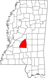 | |
| Towns | ||
| Village | ||
| CDPs | ||
| Unincorporated communities | ||
| Ghost towns | ||
| Footnotes | ‡This populated place also has portions in an adjacent county or counties | |