Rembau (town)
| Rembau Pokan Ghombau | ||
|---|---|---|
| Other transcription(s) | ||
| • Jawi | رمباو | |
| • Chinese | 林茂 | |
 | ||
| ||
| Nickname(s): Ghombau | ||
| Motto(s): Bersih, Indah, Segar | ||
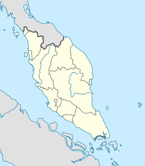 Rembau Location of Rembau in the Malaysian peninsula | ||
| Coordinates: 2°35′30″N 102°05′45″E / 2.59167°N 102.09583°ECoordinates: 2°35′30″N 102°05′45″E / 2.59167°N 102.09583°E | ||
| Country | Malaysia | |
| State | Negeri Sembilan | |
| District | Rembau District | |
| Government | ||
| • Administered by | Rembau District Council | |
| Population (2010)[1] | ||
| • Total | 29,595 | |
| • Demonym | Rembauians | |
| Time zone | UTC+8 (MST) | |
| • Summer (DST) | Not observed | |
| Postal code | 71xxx | |
| Mean solar time | UTC + 06:46:48 | |
| National calling code | 06 | |
| License plate prefix | Nxx (for all vehicles include taxis) | |
| Website |
mdr | |

The Rembau (Jawi:رمباو; Chinese: 林茂) is a town that is located in Rembau District, Negeri Sembilan, Malaysia. The township is situated about 25 km south from the state capital, Seremban, accessible through highway ![]()
Politics
Politically, only two out of four state assembly seats in the parliamentary constituency of Rembau, namely Kota and Chembong. The other two seats, Rantau and Paroi are instead administered by Nilai Municipal Council and Seremban Municipal Council respectively.
Transportation
Car
Highway ![]()
![]()
Public transport
State railway operator KTMB has a station here (code: KB16 ). It provides KTM Intercity, KTM Komuter as well as KTM ETS services.
References
- ↑ "TABURAN PENDUDUK MENGIKUT PBT & MUKIM 2010". Department of Statistics, Malaysia. Retrieved 15 December 2017.
| Wikimedia Commons has media related to Rembau. |
Capital: Seremban | |||||||||||
| Topics |
| ||||||||||
| Society |
| ||||||||||
| Administrative divisions |
| ||||||||||
| |||||||||||