Reimerswaal (municipality)
| Reimerswaal | |||
|---|---|---|---|
| Municipality | |||
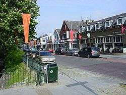 Krabbendijke town centre | |||
| |||
.svg.png) Location in Zeeland | |||
| Coordinates: 51°27′N 4°2′E / 51.450°N 4.033°ECoordinates: 51°27′N 4°2′E / 51.450°N 4.033°E | |||
| Country | Netherlands | ||
| Province | Zeeland | ||
| Government[1] | |||
| • Body | Municipal council | ||
| • Mayor | José van Egmond (CDA) | ||
| Area[2] | |||
| • Total | 242.42 km2 (93.60 sq mi) | ||
| • Land | 101.99 km2 (39.38 sq mi) | ||
| • Water | 140.43 km2 (54.22 sq mi) | ||
| Elevation[3] | 1 m (3 ft) | ||
| Population (August 2017)[4] | |||
| • Total | 22,432 | ||
| • Density | 220/km2 (600/sq mi) | ||
| Time zone | UTC+1 (CET) | ||
| • Summer (DST) | UTC+2 (CEST) | ||
| Postcode | 4400–4419 | ||
| Area code | 0113 | ||
| Website |
www | ||

Reimerswaal (![]()
Population centers
|
Topography
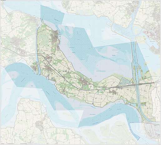
Dutch Topographic map of the municipality of Reimerswaal, June 2015
Transportation
The Railway stations from west to east are Kruiningen-Yerseke, Krabbendijke, Rilland-Bath, which all on the Staatslijn F railway from Vlissingen to Roosendaal.
References
- ↑ "Samenstelling college" [Members of the board] (in Dutch). Gemeente Reimerswaal. Retrieved 13 December 2013.
- ↑ "Kerncijfers wijken en buurten" [Key figures for neighbourhoods]. CBS Statline (in Dutch). CBS. 2 July 2013. Retrieved 12 March 2014.
- ↑ "Postcodetool for 4416AK". Actueel Hoogtebestand Nederland (in Dutch). Het Waterschapshuis. Retrieved 13 December 2013.
- ↑ "Bevolkingsontwikkeling; regio per maand" [Population growth; regions per month]. CBS Statline (in Dutch). CBS. 27 October 2017. Retrieved 27 October 2017.
External links

- Official website (in Dutch)
Places adjacent to Reimerswaal (municipality) | ||||||||||
|---|---|---|---|---|---|---|---|---|---|---|
| ||||||||||
Municipalities of Zeeland | ||
|---|---|---|
 | ||
| ||